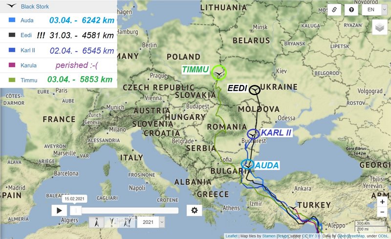
Good evening
 POLAND
 -
BocianiMy Project
http://mapa.bocianimy.pl/
New data: CNIG28 (Turek) – GUINEA

Previous info:
http://www.looduskalender.ee/forum/view ... cd#p786389
storks hatched in 2017
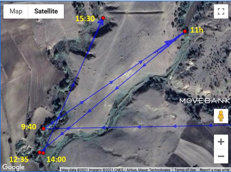
BOCZ07 Żólty/Yellow –
POLAND – Last data: 02.04. 18:26 Wintering area: Greece
Kościan County,
Žólty is not shown on the map from today. Its monitoring is likely to be interrupted during the nesting period. This was also the case last year.
Previous info:
http://www.looduskalender.ee/forum/view ... 15#p785976
storks hatched in 2019
without update:
CNIG14 – SENEGAL – new data: 28.01. 12:00 previous data: 26.01. 12:00 Previous wintering area – Senegal, Senegal river, the Djoudj National Bird Sanctuary (Parc national des oiseaux du Djoudj)
I'm a little worried about CNIG14. It has been silent since January 28. Last year, after a long break, it sent new location on April 2, when it was already on its way back north. It is also possible that the transmitter has failed. I'm still waiting for its new report

.
Previous info:
http://www.looduskalender.ee/forum/view ... 9d#p775170
storks hatched in 2020
new data:
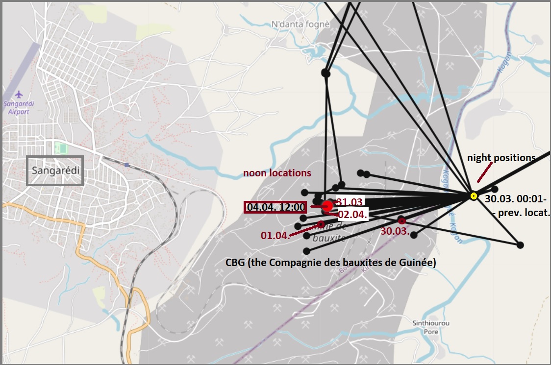
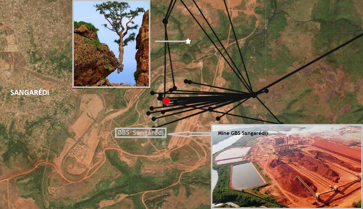
CNIG28 (Turek) – GUINEA – 04.04. 12:00 (previous data: 30.03. 00:01)
Without changing the territory. The stork remains in Guinea, east of Sangarédi. Its night positions are on a hill east of the river Kogon, noon positions are usually by the water in the area of bauxite mines (Mine GBS Sangarédi).
MAP
Previous info:
http://www.looduskalender.ee/forum/view ... cd#p783988
without update:
5764 (Miedzychód) - KENYA – new data: 01.04.08:02 Previous data: 29.03. 08:02
It seemed that the stork wanted to change its territory. In recent days, he had headed northeast. But this is not the case. He returned to his famous favorite spot on the river near the village of Kiwanja Ndege.
Previous info:
http://www.looduskalender.ee/forum/view ... 41#p784947
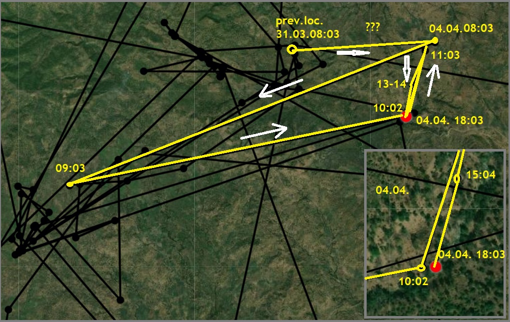
5713 (Mragowo) - ETHIOPIA - 31.03. 08:03 (previous data: 30.03. 00:03)
North Gonder – Without changing the territory, the stork remains in a mountainous area with numerous rivers southwest of Shehibi village, where it flies around.
Previous info:
http://www.looduskalender.ee/forum/view ... 41#p785565
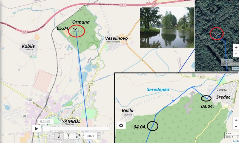
5984 (Milicz) – Côte d'Ivoire (Ivory Coast) – 22.03. 15:55 (previous data: 16.03. 15:55)
Update after 6 days. Data on March 17 – 21 is missing.
The stork discovers rivers… The stork leaved the border and flied southeast. Next location is by the Boa River. From there it headed north and its next locaion was by the Sien River. There it spent the night and and in the morning it continued north. Its last afternoon position is by the Baoulé River in the north of the country, north of Djirila village.
Previous info:
http://www.looduskalender.ee/forum/view ... 56#p783469


