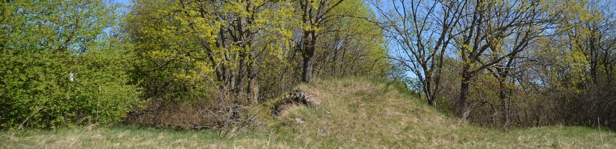
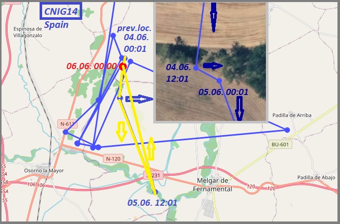
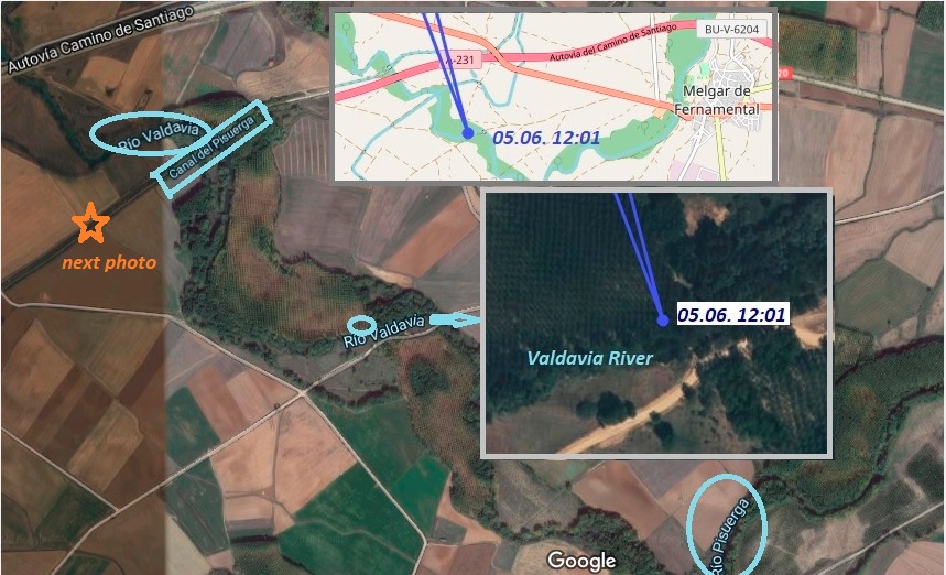
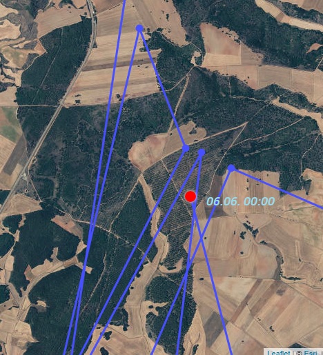
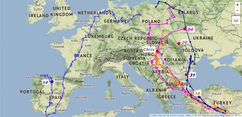
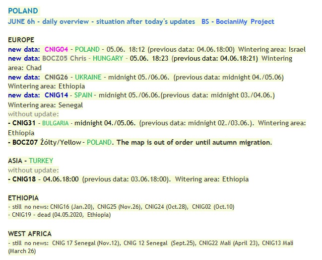
POLAND CNIG14 Spain - it is still in the area north of Mergal de Fernamental and the Valdavia River, in the fields and by the streams.
Wintering area: Senegal
CNIG 14: now without update (Spain, last data: midnight 05./06.06 - viewtopic.php?p=739364#p739364)
CHRIS: stayed in the area
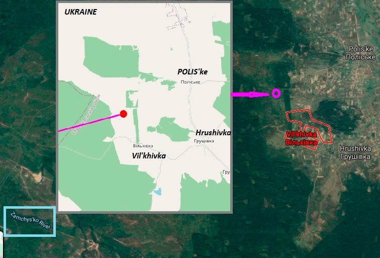
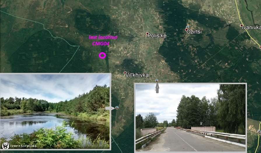
CNIG 04: Rivne Oblast, Ukranine
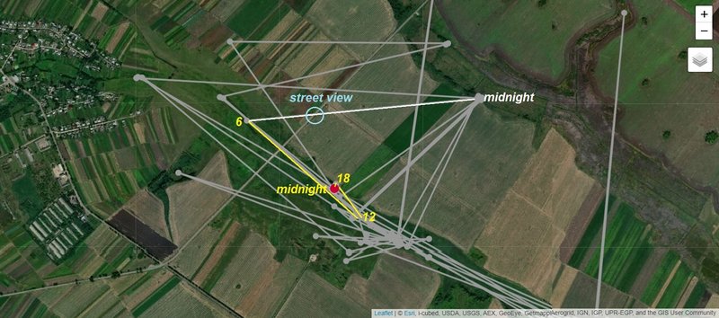
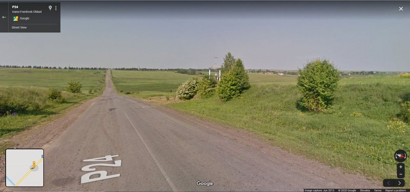
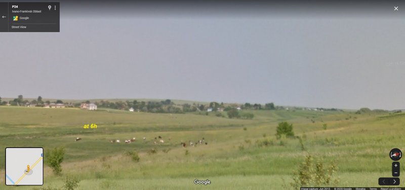
CNIG 26: stayed in the area (Ivano-Frankivsk Oblast, Ukraine)
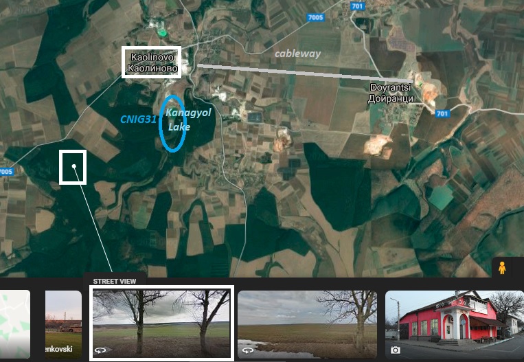
CNIG 31: still without update (Bulgaria, last data midnight 04./05.06 - viewtopic.php?p=738915#p738915)
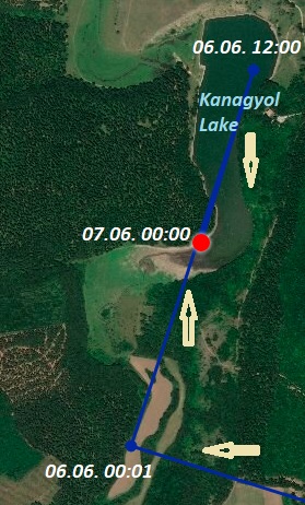
edit: CNIG 31 - update, Shumen Province, Bulgaria
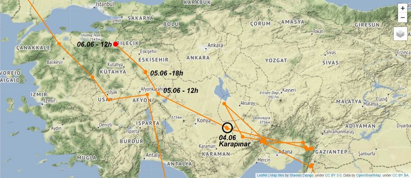
TURKEY
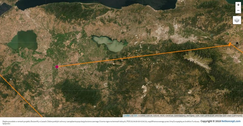
CNIG 18: maybe on the way to Europe (Bursa Province)
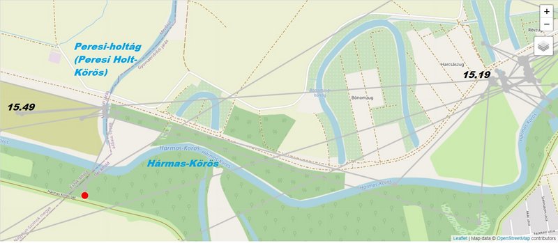
Chris stayed in Gyomaendrőd - a town in the Great Hungarian Plain upon the river Körös in Békés county, Hungary, resp. in the shallow water area the river Körös - exactly the Hármas-Körös
Chris flew yesterday in the afternoon from the favourite area to west
not far from Verbivtsi village, Horodenka Raion, Ivano-Frankivsk Oblast, Ukraine
stork arrived here on May 19
after night resting stork flew to its creak to the area not far from the village (direction west) and back to this creek on the favourite place (flew from early morning localisation direction SE)
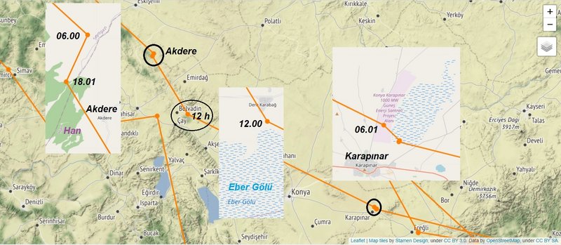
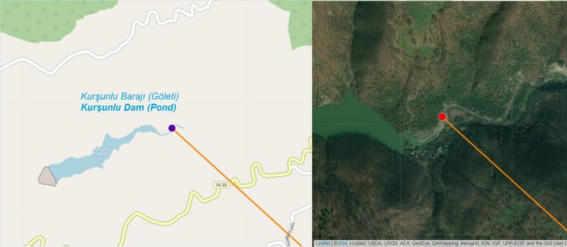
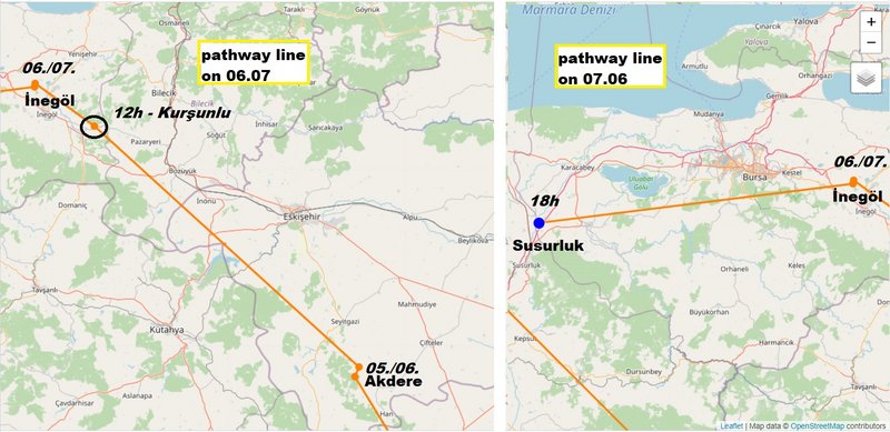
from: Karapınar - a town and district of Konya Province in the Central Anatolia region of Turkey to: Kurşunlu (dam area) - İnegöl District, Bursa Province, Turkey (via Akdere, Han District, Eskişehir Province, Turkey)
pathline on 05.06 from Karapınar to Akdere:
pathline on 06.06 from Akdere to Kurşunlu dam/pond (last data: 12 h)
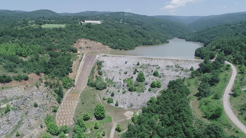
POLAND CNIG31 Bulgary - flew west to Lake Kanagyol, near the town of Kaolinovo - is a town in northeastern Bulgaria, part of Shumen Province. It is the administrative centre of the homonymous Kaolinovo Municipality, which lies in the northern part of Shumen Province. Kaolinovo was named after its main product: the municipality is rich in high-quality kaolin (china clay), with a mine and an ore dressing plant present. The reserves amount to 65 million tonnes (https://en.wikipedia.org/wiki/Kaolinovo)
Wintering area: Ethiopia
CNIG 14: flew not far south to river Pisuego, Spain
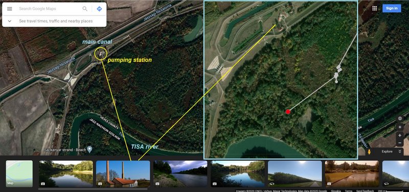
CHRIS: flew futher (direction north) to Tisza tó (lake), Hungary
CNIG 04: yesterday morning data - Rivne Oblast, Ukranine
CNIG 26: stayed in the area (Ivano-Frankivsk Oblast, Ukraine)
CNIG 31: now without update - Shumen Province, Bulgaria (last data: midnight 06./07.06 - viewtopic.php?p=739692#p739692)
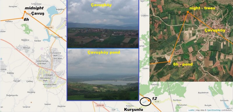
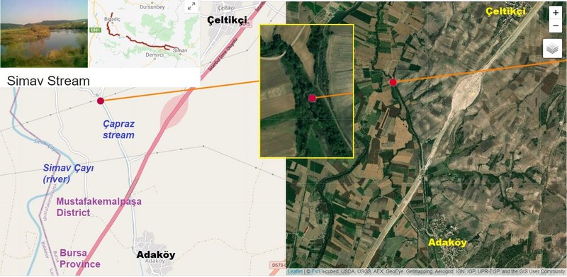
from: Kurşunlu (dam area) - İnegöl District, Bursa Province, Turkey (to Çavuşköy - village, north from İnegöl - night area 05./06.06) to: (north from) Adaköy - Mustafakemalpaşa District, Bursa Province, Turkey (06.07 - 18 h)
Çavuşköy is a village in the District of Bilecik, Bilecik Province, Turkey
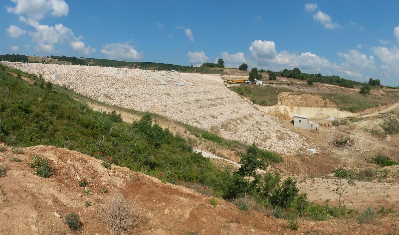
localisation at 6h Bursa İnegöl Çavuşköy Pond, which was constructed by DSI 1. (Bursa) Regional Directorate for irrigation purposes and built on Darbogaz stream, 1 km southwest of Çavuşköy village in Bursa Province, İnegöl District
Bursa İnegöl Çavuşköy Pond built within the scope of GÖL-SU Project; 25,5 meters high from the foundation, it is homogeneous soil filling type. With a pond with a storage of 525,000 m3, it is aimed to irrigate 1,410 decares of agricultural land. With the commissioning of irrigation, a net income increase of 2,158,766 TL will be achieved.
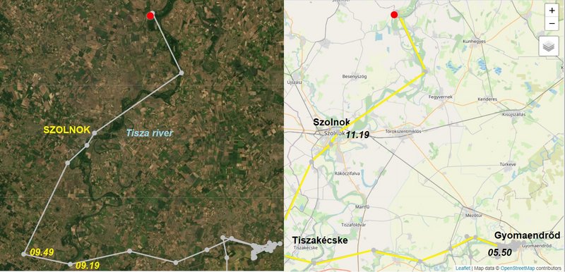
from: Gyomaendrőd - a town in the Great Hungarian Plain upon the river Körös in Békés county, Hungary, resp. in the shallow water area the river Körös - exactly the Hármas-Körösto: to: Tiszabura - a village in Kunhegyes District, Jász-Nagykun-Szolnok County, in the Northern Great Plain region of central Hungary
Chris flew yesterday first to west and not far from Tiszakécske stork changed his fly-direction to north (followed the Tisza river)
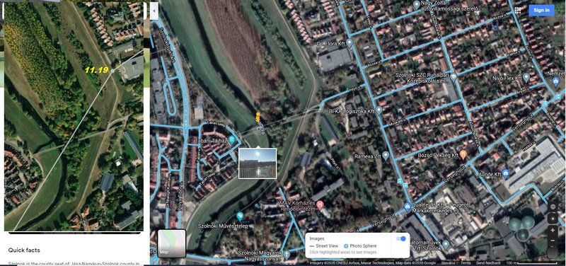
Chris has localisations above the town Szolnok (https://en.wikipedia.org/wiki/Szolnok): is the county seat of Jász-Nagykun-Szolnok county in central Hungary. Its location on the banks of the Tisza river, at the heart of the Great Hungarian Plain, has made it an important cultural and economic crossroads for centuries


