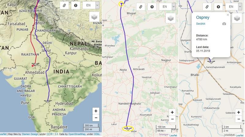
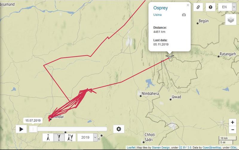
Elena (05.09.) - 7282 km Kalle (25.09.) - 9103 km Markus (31.10.) - 7879 km Serzhik (01.11.) - 4123 km (+ 26 km) Usina (01.11.) - 4359 km (+ 14 km) Vija (27.10.) - 7355 km Vova (15.10.) - 6559 km
Ahja 6 (01.11.) - 3801 km (+ 232 km)
Ahja 6 made a trip to Serbia (Vojvodina). Flew back to Lake Fehér (Kiskunság National Park). It is now in fields north of Lake.
Ahja 7 (01.11.) - 3810 km (+ 234 km)
Ahja 7 made a trip to Serbia (Vojvodina). Flew back to Lake Fehér (Kiskunság National Park). It is now in fields north of Lake. (Just like Ahja 6)
Aivar (01.11.) - 3543 km (+ 70 km)
Aivar is still in Germany, same area. He flows in fields around Linum.
Hauka 3 (01.11.) - 5541 km (+ 256 km)
Hauka 3 flew from Hungary; Lake Fehér (Kiskunság National Park) to Croatia. He is now near the town of Slavonski Brod, on the fish ponds (Jelas Ribnjaci)
Soits 1 (31.10.) - 2350 km (+ 45 km)
Soits 1 flew from lake (Fertő-laposi-tő) - Hortobágy National Park to the wetland (Hortobágyi Nemzeti Park) above the lake (Mike-laposi-tó)
Uko (30.10.) - 4679 km (+ 84 km)
Uko is still at lake Hortobágyi halastó and the fields between village Egyek and village Nádudvar
Vilja (30.10.) - 5681 km (+ 31km)
Vilja is still located on Lake Dayet El Ferd and near the village of El Aouedj
31/10/2019 Migration is particularly pronounced in the northeastern part of the country. If the number of flights in Burgundy is customary at this time, the unusual passages must rather be noted in the East (Meurthe and Moselle, Vosges, Haut-Rhin and Haute Saone).
At the same time, more than 14,000 cranes are registered in Hesse (Germany) and arrive in France.
Hesse
In Hesse since 1987, the Kranichwanderung is tracked.
In the fall and spring count daily 20 to 25 persons the Kranichwanderung. Martin Kraft sends the count results every evening via the "grus-grus" list to the migration specialists.
These counts are of great importance for the survey in Europe and especially in France for the benefit of France (Lorraine and Champagne-Ardenne).
For optimum visibility, counts are made in multiple locations at higher elevations between 300 and 400 meters above sea level near Marburg. Between Alsfeld (40 km east of Marburg) and Marburg is a 70-kilometer-long line. and Herborn (30 km southwest of Marburg).
The most important of these places are the roof of the biological faculty in the Marburger Lahn (about 400 m above sea level), the Marburger Hasenkopf west of Marburg (340 m above sea level) and the Altenberg in Odenhausen in the Lahn valley, to 17 km south of Marburg (300 m).
Pille (30.10.) - 2188 km (+ 08 km) Winter quarters (Korobkin)
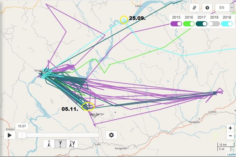
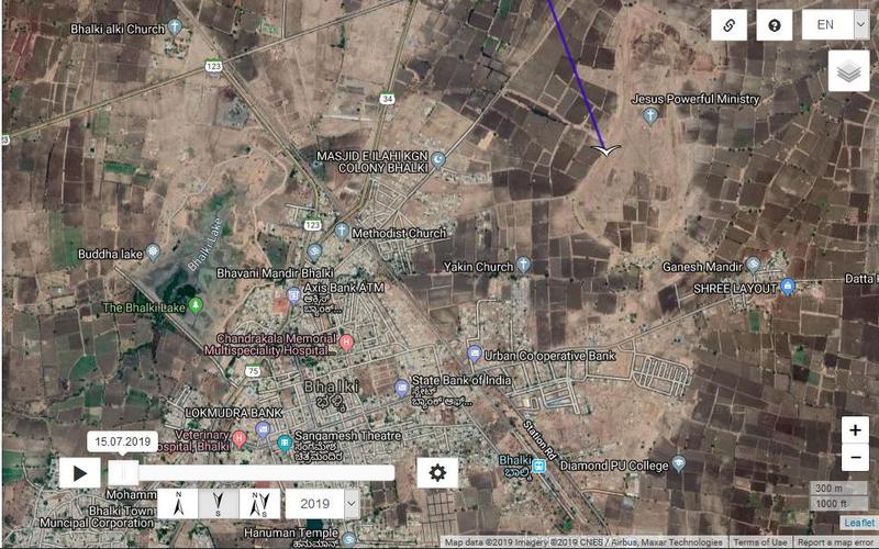
Priit (02.11.) - 3719 km (+ 705 km)
Priit flew on via Turkey (Adana, Dörtyol, Iskenderun), Syria, Lebanon to Israel.
Priit is now near Beit Rimon
Beit Rimon (Hebrew: בֵּית רִמּוֹן, lit. House of the Pomegranate) is a religious community located in the Lower Galilee Regional Council in Israel. It consists of a kibbutz and a community of privately owned homes. It is located in the Lower Galilee on a ridge of Mount Tur'an at a height of 400 meters above sea level. In 2018 it had a population of 789
Elena (05.09.) - 7282 km Kalle (25.09.) - 9103 km Markus (03.11.) - 7887 km (+ 08 km) Serzhik (01.11.) - 4123 km (+ 26 km) Usina (01.11.) - 4359 km (+ 14 km) Vilja (03.11.) - 7533 km (+ 178 km) Vova (15.10.) - 6559 km
VOVA - in his wintering area (he arrived there maybe before Sept.27)
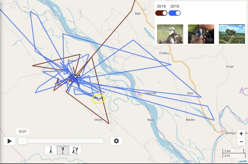
Vova is in Niger - Kogi state - south from little village Budon - in flooding area the river Niger
update after longer time
previous data:
Distance: 6559 km Last data: 15.10.2019 new data:
Distance: 6808 km Last data: 06.11.2019
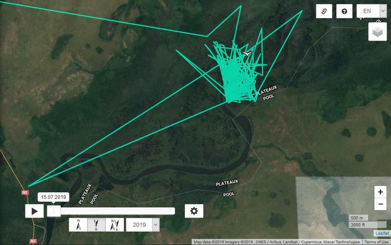
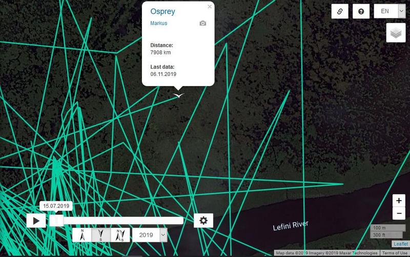
MARKUS - in his wintering area (he arrived there maybe before Oct. 29):
- Lefini river area, north-east from Moembe - town in Lekana District in the Plateaux Department of the Republic of the Congo
previous data:
Distance: 7887 km Last data: 03. 11.2019 new data:
Distance: 7908 km Last data: 06.11.2019
KALLE - in his wintering area
Congo river area in the Lulua District located in the Kasai-Occidental province in the southern part of the Democratic Republic of the Congo
new data
Distance: 9415 km Last data: 06.11.2019 previous data:
Distance: 9388 km Last data: 05.11.2019 (viewtopic.php?p=699812#p699812)
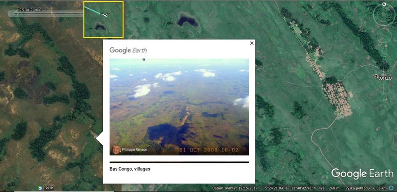
Demba (Democratic Republic of the Congo, Bas-Congo)
VIJA - in her wintering area (arrived there on Sept. 26)
- western coastline on the Atlantic Ocean, Ouad Naga Department, Trarza region in southwest Mauritania, south from the Mauritanian capital Nouakchott
Elena
Distance: 7282 km Last data: 05.09.2019 (viewtopic.php?p=692211#p692211)
she is very probably out from GSM coverage area as previous years: new data: 20.03.2019, after 6 month silence (last data: 13.09.2018) more here: viewtopic.php?p=692180#p692180