I will believe on kuhankeittäjä's theorie that there is still a chance, that Paike is alive!
Thank you all for your work! A daily report by tracker map is in my opinion not necessary. You have enough work!

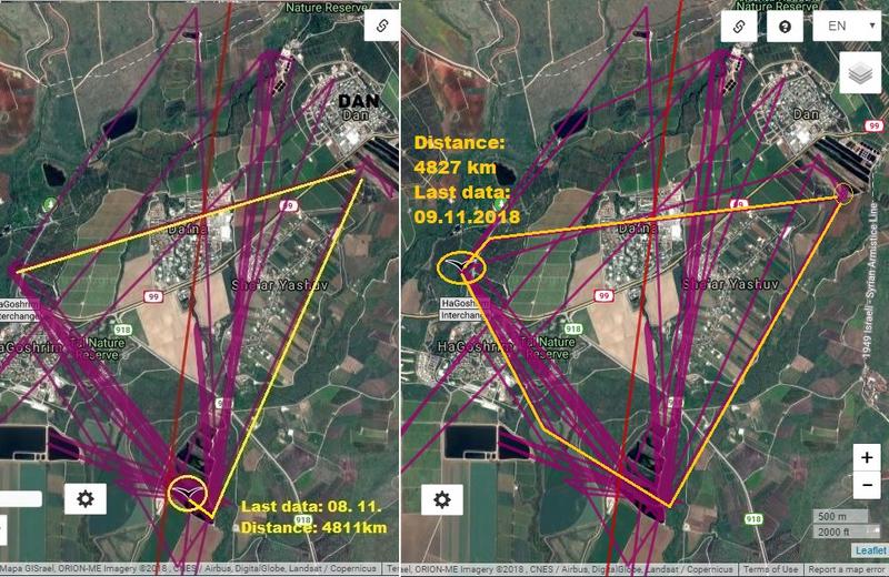
Many thanks for the very useful information, Urmas.Urmas wrote: ↑November 8th, 2018, 6:58 pm ... It could be like compass azimuth (course) with value of 0-360 degrees. As much as I know it is calculated for every moment if location is calculated. Direction or course doesn't care about heading of the bird, it can even fly tail in front and belly up, but course (direction) is still only one. So if the bird is soaring, the direction is like a tangent to the cycle (if it is correct in English?). Last location of Päike has direction of 316 degrees, what means roughly NE. But I'm almost sure he was soaring that time...
Hi, kuhankeittäjäkuhankeittäjä wrote: ↑November 8th, 2018, 8:02 pm ... Edit: Meanwhile Urmas has answered. Direction means GPS direction of movement (direction of velocity vector) during coordinate determination by satellites; a tangent of the true flight path at given coordinates. Last known direction was towards the middle finger of mainland. ...
 ]
]


Thank you, Jo.
Thanks, Solo
Hello, Sova. Thank you.sova wrote: ↑November 9th, 2018, 3:56 pm Dear Anne ... as Jo said, you have invested a lot of effort in this map.Thank you so much.
Now that we have seen direction as Päike has flown (if I understand correctly), the last 1/2 hour is like a mad flight (panic?).
I hope she has reached coast but the point 7 does not suit me.
e.g. Golden Eagle attacks Black Stork (nothing bad) https://youtu.be/OwqCEv8eTqQ
Solo wrote: ↑November 9th, 2018, 5:15 pm e.g. Golden Eagle attacks Black Stork (nothing bad) https://youtu.be/OwqCEv8eTqQ
The flights above the islands can certainly be explained by the search for thermals.sova wrote: ↑November 9th, 2018, 5:14 pm Anne, when I read Solo's Post, looking for a thermals. All right ... that would also explain that she first NE and then SW flies. But those are last two points .... we do not know any more. Bird of prey .... I personally do not believe.
I've always wondered if this is just Päik's flight or was the entire group involved.
I don't know either, Sova.

Hello, raija!
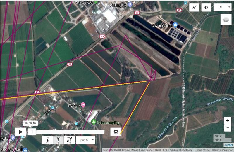
Made wrote: ↑November 9th, 2018, 9:36 pm Anne7, nice map! I take two indicators from it
I tried to look on speed and altitude (and vice versa) of seven Päike`s points and now I don`t understand:
1) is there some correspondence with lifting up in thermals?
2) is the last point in trend line, or is it out of normal behaviour?
Most probably there is not enough data to answer decently
Thank you, Hellem!