

Weather data - 10:00
temp; 20 °
Precipitation; 0 mm

Humidity; 40%
Air pressure; 1018 hPa


That's what I'd hoped. This is super!Anne7 wrote: ↑November 11th, 2018, 7:57 pm Ornitela apparently (automatically?) retrieves new data every 6 hours. (Not at the same time for Maru and Karula, though...)
Birdmap has to be updated (manually) by somebody, I think.
So, if we have no birdmap-update for a long(er) time (or if there are worries), we can now make a tracker map, on request. :thumbs

Michi, Ornitela is the seller (the brand) of the transmitters.
I‘ve another question, because I’m not sure if I understand right. If Ornitela retrieves new data every 6 hours, does it then receive all data from the last 6 hours? Every 15 minutes?
I think the backpack gets BS data (among other things coordinates) from GPS satellite. Backpack logs to the GPS satellite every 15 minutes and saves the data to backpack memory.Jo UK wrote: ↑November 12th, 2018, 11:09 am Good morning, Michi.
The backpacks collect and save the data every 15 minutes.
Every 6 hours that information is sent to the satellite which sends it to the data collection place.
Well, I am not certain when the back pack sends the data - it could be every 15 minutes but we can collect it every 6 hours.
Birdmap - Urmas updates birdmap - if he is busy and can't do the update at a certain time, we can go to the data collection point and make a map (well, Anne can. Not sure about my browsers, yet)
Thanks, Sova!


Hellem
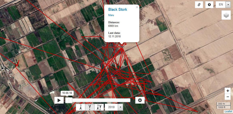
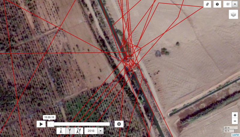
Anne7 wrote: ↑November 12th, 2018, 9:32 pm MARU's TRACKER MAP from today:
https://drive.google.com/open?id=1ZLrsO ... sp=sharing
KARULA's TRACKER MAP from today:
https://drive.google.com/open?id=1Shbx3 ... sp=sharing