Migration Map

Migration Maps, Tõnn, Greater Spotted Eagle and Black Storks
Post Reply
Solo
Registered user
Posts: 23861
Joined: October 19th, 2015, 7:18 pm

Re: Migration Map

Post by Solo »

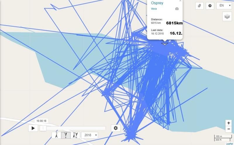
sova wrote: December 16th, 2018, 8:24 pmSolo :hi: .... Vova has new data
Sova, thank you for the hint and today PM about that news :wave:

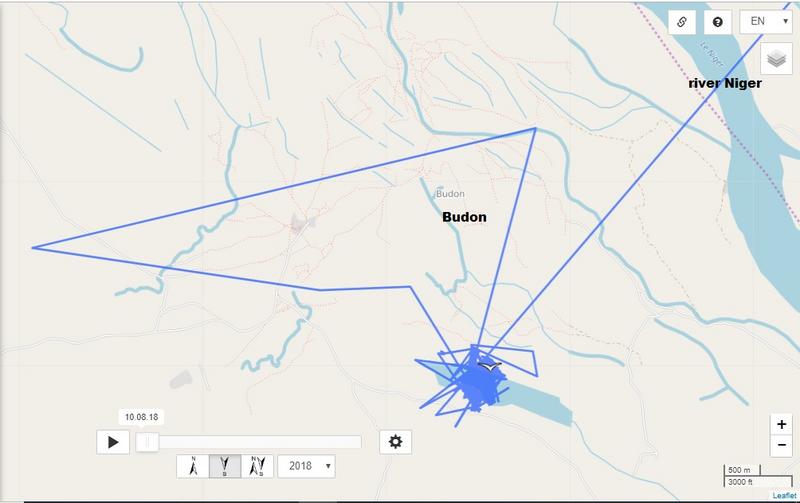
VOVA - still in his area :D (Kogi state in the central region (Middle-Belt) of Nigeria. wiki)

Image

Image

Image
Solo
Registered user
Posts: 23861
Joined: October 19th, 2015, 7:18 pm

Post by Solo »

December 18
:hi: all together

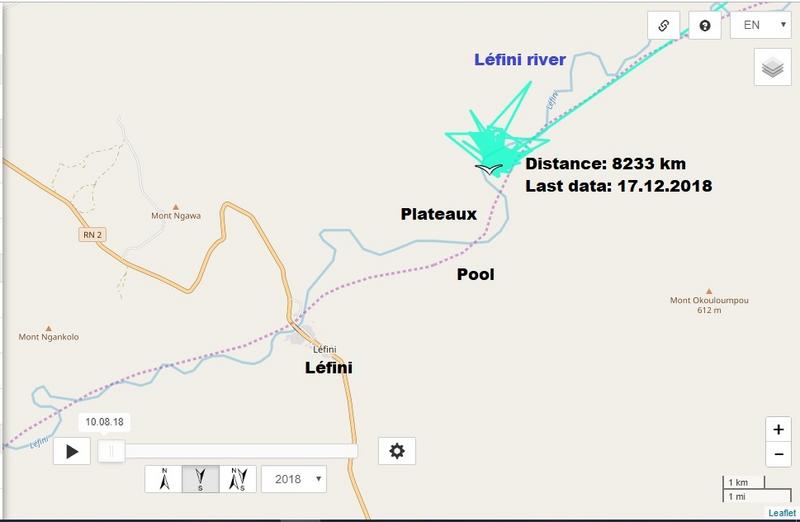
osprey MARKUS
previous data: Distance: 8229 km, Last data: 15.12.2018 (4 day - plus 8 km, 2km/day :D )
new data: Distance: 8233 km, Last data: 17.12.2018 (2 day - plus 4km)

Image
User avatar
sova
Registered user
Posts: 29384
Joined: October 14th, 2015, 7:11 pm

Post by sova »

:hi:

17.12.
Aivar is still in the same area (Enfidha Hammamet Airport)
Image

Image
User avatar
sova
Registered user
Posts: 29384
Joined: October 14th, 2015, 7:11 pm

Post by sova »

17.12.

Soits 1 and Soits 2 are also in the same area (Sebkht Cherita wetland)
Image

Image

Image
User avatar
sova
Registered user
Posts: 29384
Joined: October 14th, 2015, 7:11 pm

Post by sova »

18.12.

Hauka 3 is still in Jelas Ribnjak in Croatia
Image

18.12.

Uko - Hungary (near the village Bokros)
Image

Image
User avatar
sova
Registered user
Posts: 29384
Joined: October 14th, 2015, 7:11 pm

Post by sova »

winter quarters

17.12.
Loode
Image
Paslepa
Image

No new data

Ahja 5 (04.12.)
Ivar (19.11.)
User avatar
sova
Registered user
Posts: 29384
Joined: October 14th, 2015, 7:11 pm

Post by sova »

20. December

Last data from 14.12.
Ivar flew on .... from Croatia, across the Adriatic Sea, to the Bay of Naples, Ischia .... across the Mediterranean to Tunisia.
Ivar is also near the river port (Enfidha Hammamet)

Image

Image

Ivar is almost in winter quarters. Question is; Which one do we choose? :D
Image
User avatar
sova
Registered user
Posts: 29384
Joined: October 14th, 2015, 7:11 pm

Post by sova »

19.12.
Aivar is still near the Flufhafen (Enfidha Hammamet)

Image

Image

Image
Solo
Registered user
Posts: 23861
Joined: October 19th, 2015, 7:18 pm

Post by Solo »

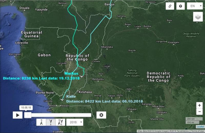
osprey MARKUS
previous data: Distance: 8233 km, Last data: 17.12.2018 (2 day - plus 4km)
new data: Distance: 8238 km, Last data: 19.12.2018 (2 day - plus 5km)

Image

Image

photos and reading about that area e.g. here https://thecopperbeltbible.wordpress.com/
photos from this blog here viewtopic.php?p=425849#p425849

Image
source (and more infos) http://datazone.birdlife.org/site/facts ... -iba-congo
User avatar
sova
Registered user
Posts: 29384
Joined: October 14th, 2015, 7:11 pm

Post by sova »

19.12.
Soits 1 and Soits 2 flew north again (Sebkhet Khedma el Kebira)
Image

Image

Image

The Sebkha Kelbia (سبخة الكلبية) is an intermittent lake in Tunisia that covers 8000 hectares in Sousse Governorate, at 35°50'34"North, 10°16'18"East, south of Kondar.

Considered the second most important wetland in the country after lake Ichkeul, it is classified a nature reserve by decree of the Ministry of Agriculture of 18 December 1993. The Oued Nebhana, Oued Merguellil and Oued Zeroud rivers flow into the dry lakebed during rainfall season, but are now controlled by dams protecting the plain against the floods. The dams coupled with the operation of large agricultural irrigation schemes have had an environmental impact on the sebkha, which has not been studied to date. The agricultural population living around Sebkha Kelbia is estimated at about 23,000 people.
https://en.wikipedia.org/wiki/Sebkha_Kelbia
User avatar
sova
Registered user
Posts: 29384
Joined: October 14th, 2015, 7:11 pm

Post by sova »

20.12.

Hauka 3 - Still in Croatia (Jelas Ribnjaci)
Image

Will she stay in Croatia? ... or is she going back to Hungary?
Image
User avatar
sova
Registered user
Posts: 29384
Joined: October 14th, 2015, 7:11 pm

Post by sova »

19.12.

Uko is still in Hungary near the village of Bokros
Image

Uko is waiting for a longer trip
Image
User avatar
sova
Registered user
Posts: 29384
Joined: October 14th, 2015, 7:11 pm

Post by sova »

winter quarters
19.12.

Image

Image


Ahja 5 (no new data since 04.12.) - Hungary
User avatar
sova
Registered user
Posts: 29384
Joined: October 14th, 2015, 7:11 pm

Post by sova »

Pille (19.12.)
6 days - 22 km
Image

Image
User avatar
Bea
Moderator
Posts: 28724
Joined: January 15th, 2011, 1:02 pm
Location: Bavaria, Germany

Post by Bea »

°°°°°°°

Russian White tailed Eagle Boy

Last data 19.12.2018

Boy, a young White tailed Eagle from Russia, seems to have similar ideas like Estonian Greater spotted Eagle Pille about nice wintering grounds :D

He left his "home area" Tatarstan/Uljanowsk, where he roamed along the river Volga, and followed the Volga river course ...

Image

Image
Nature does nothing in vain (Aristoteles)
User avatar
Bea
Moderator
Posts: 28724
Joined: January 15th, 2011, 1:02 pm
Location: Bavaria, Germany

Post by Bea »

°°°°°

.... until he changed over to the river Don, followed it a while and is heading to the Sea of Azov now

Image

Image

I am curious how his ways will go on.
Nature does nothing in vain (Aristoteles)
User avatar
sova
Registered user
Posts: 29384
Joined: October 14th, 2015, 7:11 pm

Post by sova »

22. December

Aivar (22.12.)
Image

Image

Image
User avatar
sova
Registered user
Posts: 29384
Joined: October 14th, 2015, 7:11 pm

Post by sova »

Uko (22.12.) Is Hungary near the village of Baks

Image

Image

Image
User avatar
sova
Registered user
Posts: 29384
Joined: October 14th, 2015, 7:11 pm

Post by sova »

Ahja 5 has new data (10.12.) He / she is in Serbia. Near the village; Srpski Krstur

Image

Image

Image
User avatar
sova
Registered user
Posts: 29384
Joined: October 14th, 2015, 7:11 pm

Post by sova »

25. December

Aivar (24.12)
Image

Image

Image
https://www.google.ch/maps/place/%D8%B3 ... 2361?hl=de

The dam Mellègue or dam Nebeur (French Barrage Mellègue or Barrage de Nebeur, Arabic سد ملاق, DMG Sadd Mallāq) is located in Tunisia in the governorate of Kef. It dams up the Oued Mellègue to a reservoir. The town of El Kef is located about 15 km south of the dam.

The dam was built in the years 1949-1956 by the French colonial rulers. It is used for irrigation, flood protection and power generation. [1]
Post Reply

Return to “Migration Maps and News”