in preparation - done
ESTONIA - continuation
Solo wrote: ↑September 25th, 2020, 11:54 am
birdmap update:
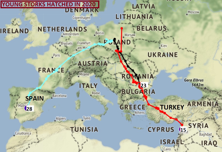
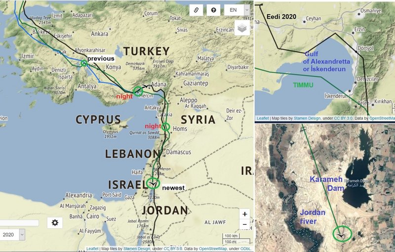
TIMMU (24.09) - already in front of Dead Sea, KARL II (25.09) - still in the same area (after trip to other irrigated fields to the north), VEDRU (25.09) - still in the same area (after trip to east) and EEDI (25.09) - in the same area near the village Wadi Tarj
(in this moment without update: Karula - 23.09; Auda - 23.09) ...
previous info (overview 24.09):
viewtopic.php?p=764417#p764417 and
viewtopic.php?p=764429#p764429 + Eedi
viewtopic.php?p=764442#p764442 and next
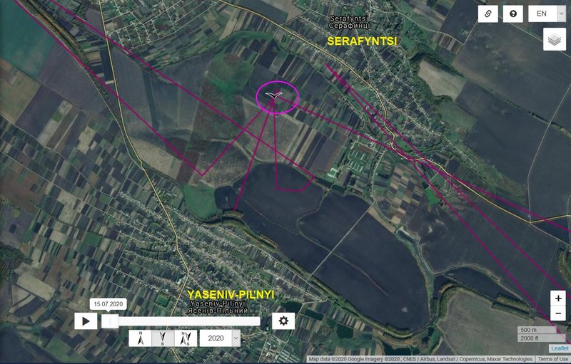
 KARULA - Ukraine, plus 35 km
- previous data Distance: 2008 km, Last data: 22.09.2020; Serafyntsi - village in Horodenka Raion, Ivano-Frankivsk Oblast, Ukraine (on the field)
- new data: Distance: 2043 km, Last data: 23.09.2020; south from Serafyntsi - village in Horodenka Raion, Ivano-Frankivsk Oblast, Ukraine (on the field and pond)
- localisation (click): https://i.postimg.cc/xd8Xv4rn/2020-09-24-karula-sit.jpg
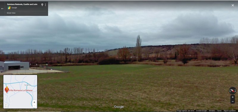
- street view: https://goo.gl/maps/pkRUsFQamSe9KSwC6 (very distance view to his area on the field), btw. they have also war cemetery
https://goo.gl/maps/sgKi2LofuyKEeJAY7
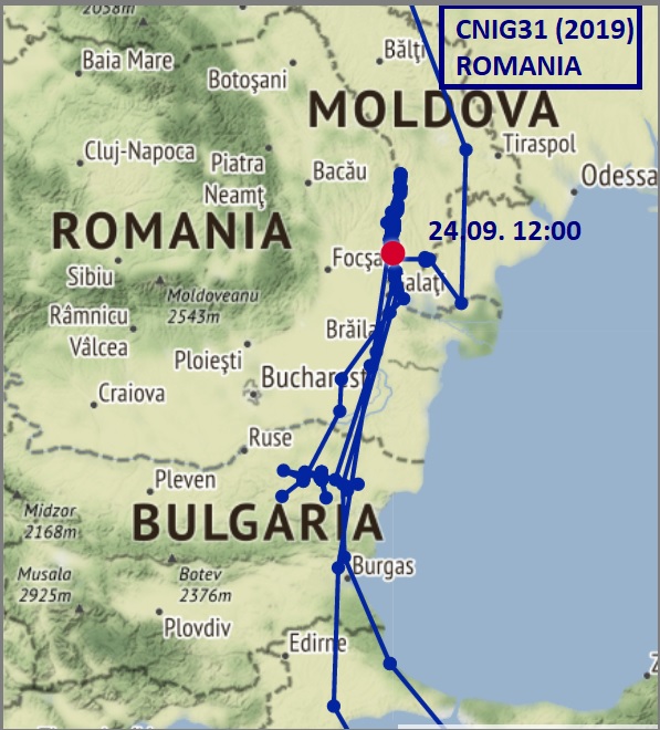
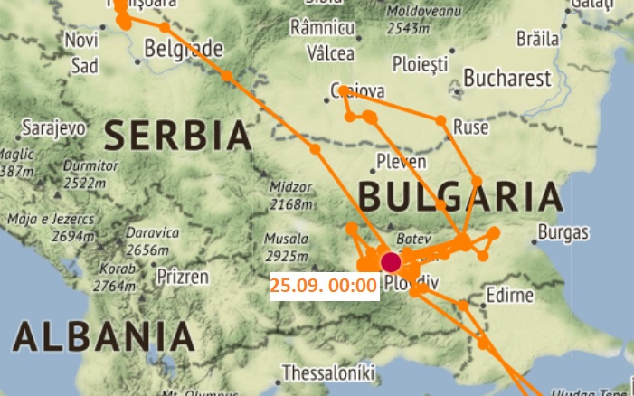
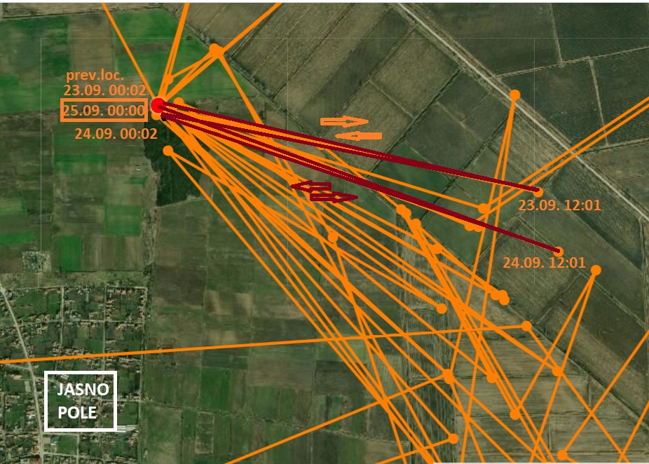
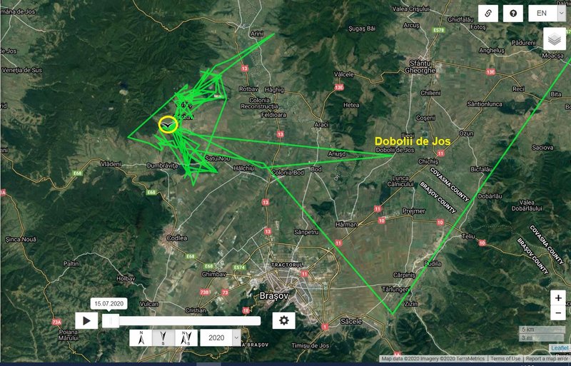
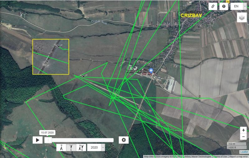
VEDRU - Romania,
plus 60 km
-
previous data: Distance: 2194 km, Last data:24.09.2020; south from Crizbav (Cutuș - is a commune in Brașov County, Transylvania, Romania. It is composed of two villages, Crizbav and Cutuș) - localisation is near one of many streams in this area
-
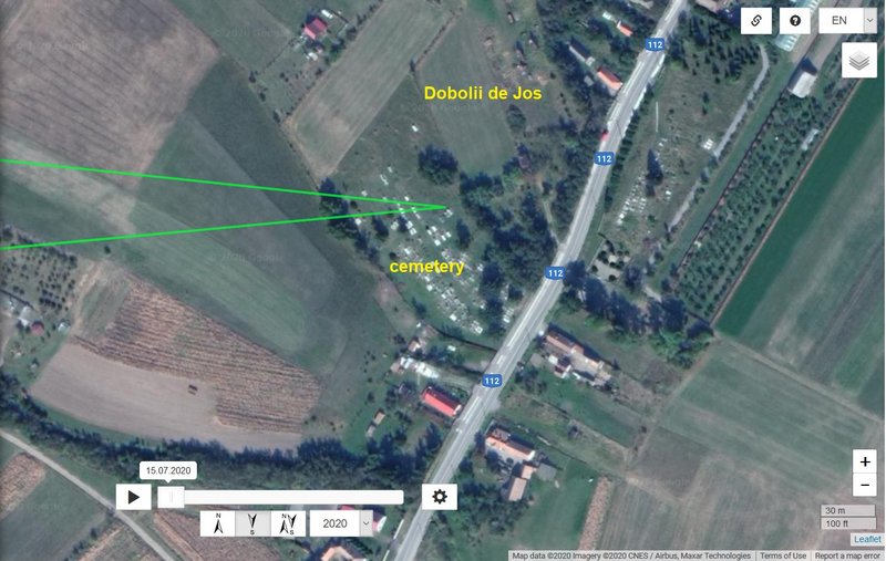
new data: Distance: 2254 km, Last data: 25.09.2020; after trip to east (to village Dobolii de Jos/cemetery) stork is back in previous area SW from Crizbav (location is near one canal)
-
localisation (click): situation:
https://i.postimg.cc/YShzBFkf/2020-09-25-v-sit1.jpg, trip to east:
https://i.postimg.cc/VLWRq1DM/2020-09-2 ... de-jos.jpg and location near Crizbav
https://i.postimg.cc/MpsmL5kp/2020-09-25-v-detail.jpg
-
street view: location in cemetery, image capture Sep 2012 -
https://goo.gl/maps/VvXoui421mN1CMPN6 and photo - Crizbav area
https://goo.gl/maps/EfCTskTSyWcbKXEb9
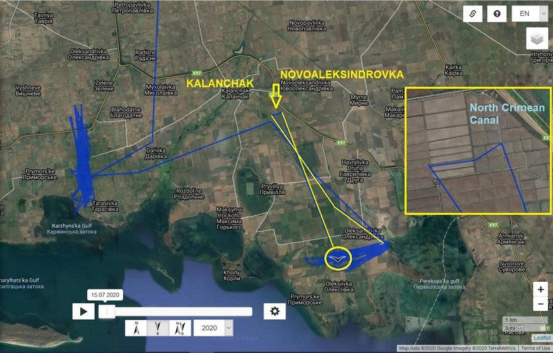
KARL II - Ukraine,
plus 44 km
-
previous data: Distance: 2192 km, Last data: 24.09.2020;; irrigated fields area near Oleksandrivka, Kherson Oblast, Ukraine (Perekops'ka gulf - bay in the north-eastern part Karkinits'ka bay of the Black Sea)
-
new data: Distance: 2236 km, Last data: 25.09.2020; stork stayed in the area after trip to other irrigated fields to the north (south from Kalanchak, west from the main canal:
https://en.wikipedia.org/wiki/North_Crimean_Canal))
-
localisation: https://i.postimg.cc/m23qs8t3/2020-09-25-karl2.jpg
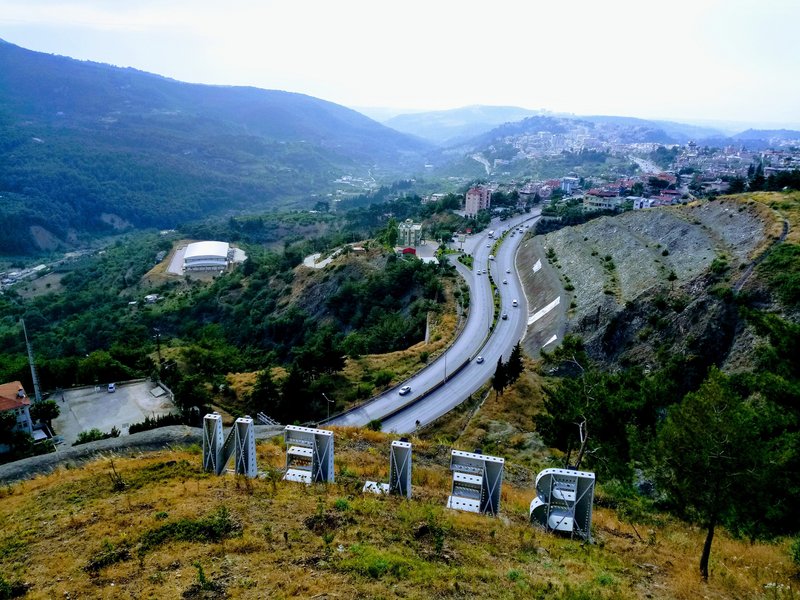
AUDA - TURKEY, 313 km
- previous data: Distance: 2986 km, Last data: 22.09.2020; G
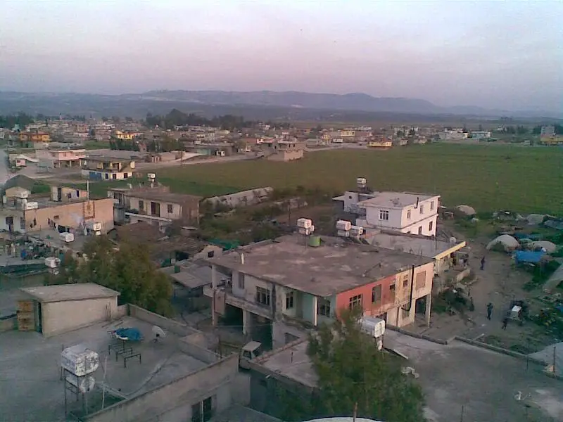
- new data: Distance: 3299 km, Last data: 23.09.2020; localisation is NW from Söğütlü - a village in the District of Karaisalı, Adana Province, Turkey (forest area)
- localisation click: https://i.postimg.cc/jSVnrXJh/2020-09-24-auda-sit.jpg and https://i.postimg.cc/FKVP2pDf/2020-09-2 ... detail.jpg
- photo: 1/her area on 22.09: https://goo.gl/maps/Ur9X6z8w3xRMSc3R7 and 2/ location on 23.09: https://goo.gl/maps/qyfeCQMCgrHUpEYk7
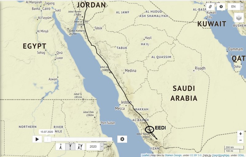
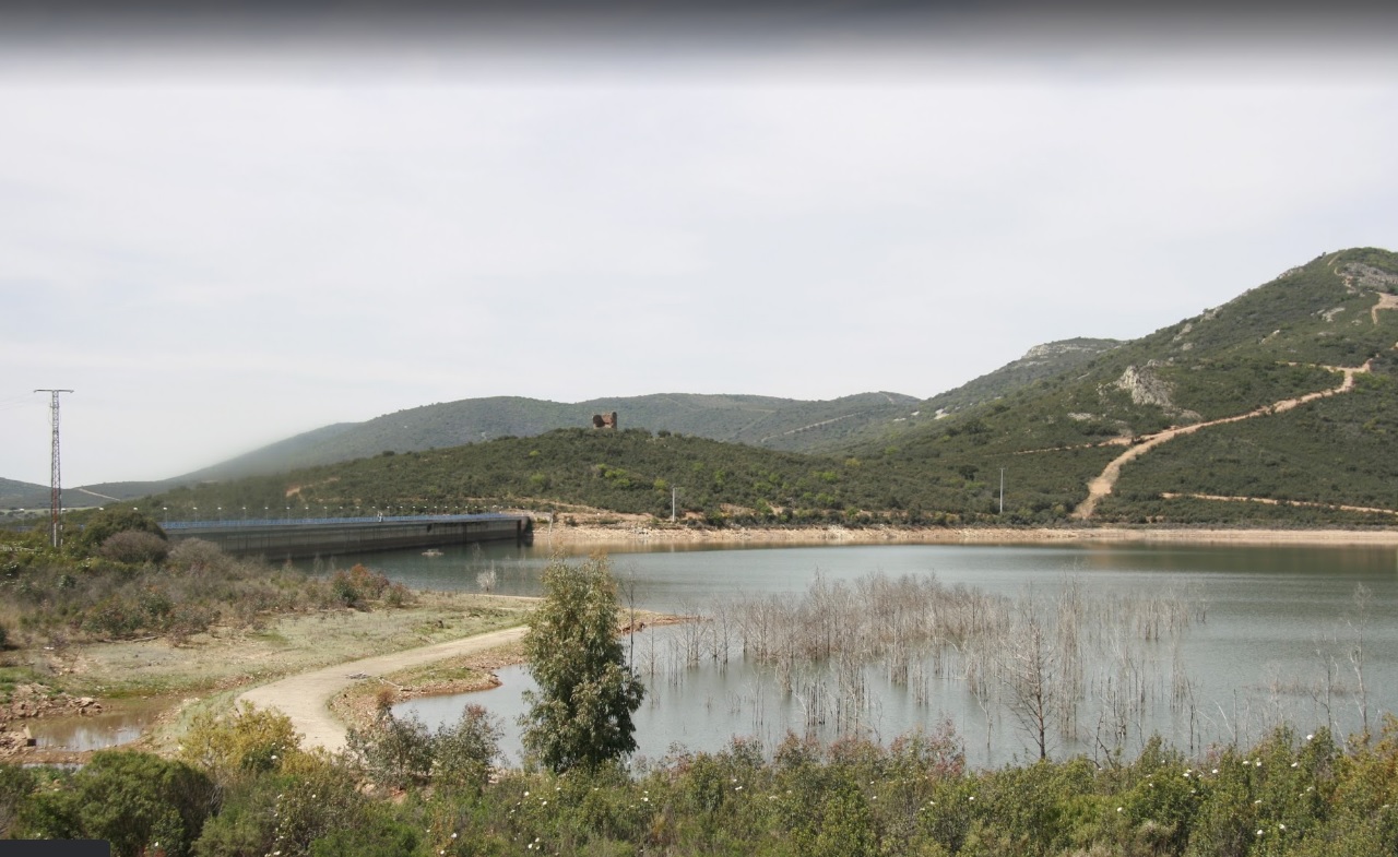
TIMMU - JORDAN,
plus 1002 km
-
previous data: Distance: 3583 km, Last data: 22.09.2020; north from village Hamitler, Gökbudak commune, district: Ilgın, province: Konya, Turkey
-
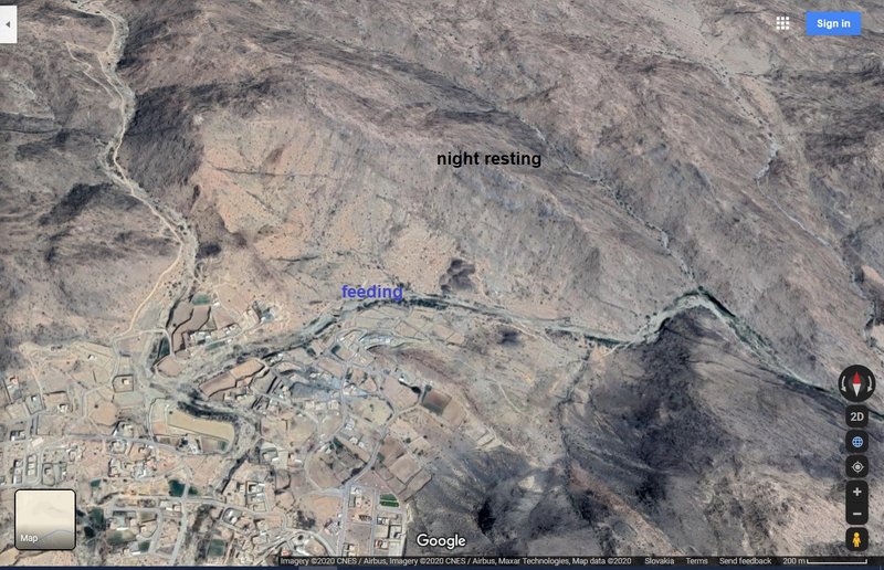
new data: Distance: 4585 km, Last data: 24.09.2020; south from Karameh Dam, Shuna al-Janubiyya Department, Balqa Governorate, Jordan (north of the Dead Sea)
-
localisation click:
https://i.postimg.cc/dVZwLq2R/2020-09-25-TIMMU.jpg
-
photo: Karameh Dam area from plain (Oct 2019)
https://goo.gl/maps/5d66745LMmjjzDxc7 or older, but maybe better view on his location
http://wikimapia.org/12831012/Al-Karame ... to/6237716
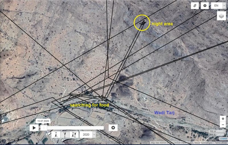
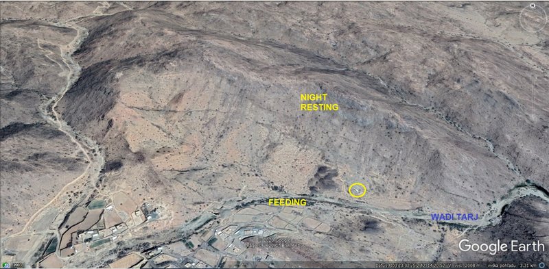
EEDI - Saudi Arabia,
plus 17 km
-
previous data:: Distance: 6966 km, Last data:24.09.2020; south-east from Al Namaas, Aseer Province - Asīr Region, Saudi Arabia (near the village Wadi Tarj, stream area)
-
new data:: Distance: 6983 km, Last data: 25.09; - stayed in the area
-
more: viewtopic.php?p=764557#p764557


