Following Karls' Families

Migration Maps, Tõnn, Greater Spotted Eagle and Black Storks
Post Reply
User avatar
sova
Registered user
Posts: 29430
Joined: October 14th, 2015, 7:11 pm

Re: Following Karls' Families

Post by sova »

Anne7 wrote: October 26th, 2020, 7:29 pm ...

Seasonal Variation of Hafirs' Water Quality in North Kordofan State - Sudan
...
Thank you Anne ... it would be better I didn't read it.
I mean, we / I care about the animals / birds ... and the people? The world is just unjust ... in so many things ...
User avatar
Anne7
Registered user
Posts: 10604
Joined: April 15th, 2016, 3:26 pm
Location: Belgium

Post by Anne7 »

sova wrote: October 26th, 2020, 8:29 pm Thank you Anne ... it would be better I didn't read it.
I mean, we / I care about the animals / birds ... and the people? The world is just unjust ... in so many things ...
While doing the dishes I was thinking the same, Sova. We have always drinking water available, we are never hungry, we have a decent roof over our heads, good health care and education ... And all this only because we happen to be lucky enough to live in a prosperous country.
No, the world is not fair.
“Clearly, animals know more than we think, and think a great deal more than we know.”
— Irene Pepperberg
User avatar
Michi
Registered user
Posts: 3877
Joined: May 4th, 2013, 3:30 pm
Location: Berlin, Germany

Post by Michi »

Good evening everyone,

Anne :wave: Many thanks for all informations about the hafirs! This all sounds quite bad and I hope, Karl II is already far away from this waterhole. He only can get sick there.
Anne7 wrote: October 26th, 2020, 6:07 pm I made some pictures of that place on a different map.
It looks really impressive.
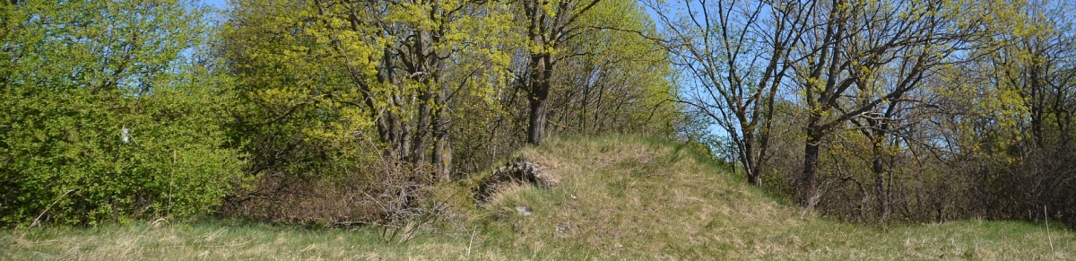
On this map it looks like a big pit in the landscape, with steep embankments. :puzzled:
https://up.picr.de/39730138nu.jpg
...
A stork would certainly not enter such a hole if there is no shallow bank. This one looks pretty horrible, - very unhealthy.

I took pictures from GE, they are probably newer, from April 2019 and March 2020, where the bank is much flatter. Anyway, I don't think Karl II stopped there, - just a feeling.

Picture from April 2019.
Image

The northern edge of the hafir. Viewing height is 1,1 km. The dark points you see are most likely bushes (at least it looks like that when I zoom in more).
The picture was taken in March 2020, so it is brand new. However, spring and summer are gone and it will certainly look different now, drier.
Image

The settlement Anne has found. Anne, you must have eagle eyes! :)
Image

This settlement looks depressing. The people who live there, are certainly very, very poor and one asks oneself what they live on. :unsure:
Once I saw a TV documentary about people in Sudan who lived in a small desert settlement. Because there were no greens for the goats, the people tore cardboard boxes into small pieces and gave these pieces to the goats to eat. Really, the goats ate the cardboard. The poor animals were of course all sick and terribly undernourished from this "food".
This awful story touched me deeply.
The area here looks like the settlement in the documentation. What should goats eat here? There is nothing. Or could the bushes still have green leaves in autumn? Surely not.
Also large birds like storks will hardly find anything to eat here. Rather, they are in danger of being killed and eaten by the inhabitants of the settlement.

Sova, Anne, I fully agree. The world is not fair. :unsure:

Sorry, if this is a bit OT.
User avatar
Anne7
Registered user
Posts: 10604
Joined: April 15th, 2016, 3:26 pm
Location: Belgium

Post by Anne7 »

October 27th

Hello, everyone :hi:

Michi, many thanks! :wave:
Oh dear, what a distressing story! Poor goats... and poor poor people... :shock:


There has been a birdmap update for Karula, Timmu and Vedru.
I will document it as soon as possible.

BIRDMAP OVERVIEW

KARULA
• Previous data: 23.10.2020, distance 4756 km (+10 km in 2 days), near Tal Al-Mantah in the Jordan River Valley, Israel/Jordan
NEW data: 26.10.2020, distance 4773 km (+17 km in 3 days), near Tal Al-Mantah in the Jordan River Valley, Israel/Jordan

KARL II
• Previous data: 23.10.2020, distance: 7111 km (+1169 km in 4 days), in the desert of North Kordofan in Sudan.
• NO NEW data.

EEDI
• Previous data: 17.10.2020, distance 7893 km (+71 km in 1 day), near Al Namas in Saudi Arabia
• NO NEW data.

TIMMU
• Previous data: 23.10.2020, distance 7209 km (+28 km in 2 days), still near Metema, on the Atbarah River (tributaries) in Ethiopia.
NEW data: 26.10.2020, distance 7248 km (+39 km in 3 days), still near Metema, on the Atbarah River (tributaries) in Ethiopia.

VEDRU
• Previous data: 25.10.2020, distance 3792 km (+242 km in 2 days), near Çifteler, Eskişehir Province in Turkey.
NEW data: 27.10.2020, distance 3996 km (+204 km in 2 days), on the shores of Lake Tersakan, Konya Province, Turkey

AUDA
• Previous data: 05.10.2020, distance 6903 km (+244 km in 1 day), near Am Ouch, in the Ouaddaï region in Chad.
• NO NEW data.


Karula, same area
Image

Timmu, same area
Image


Vedru, on the shores of Lake Tersakan, Konya Province, Turkey.

"Lake Tersakan is a saline lake situated to the west of Tuz lake (site 072), fed by springs, surface run-off and drainage. Large areas of mudflat and small areas of freshwater marsh occur; otherwise the lake has virtually no fringe vegetation. Non-irrigated arable fields surround the lake, sheep graze the shores and mining takes place at the Alkim saltpans to the north.
Key biodiversity: In winter, significant numbers of wildfowl occur."
http://datazone.birdlife.org/site/facts ... iba-turkey

Image
“Clearly, animals know more than we think, and think a great deal more than we know.”
— Irene Pepperberg
User avatar
Anne7
Registered user
Posts: 10604
Joined: April 15th, 2016, 3:26 pm
Location: Belgium

Post by Anne7 »

:hi:

TRACKER MAP
Karula_October27
https://www.google.com/maps/d/edit?mid= ... sp=sharing

Karula is still in the same area near Tal Al-Mantah in the Jordan River Valley, Israel/Jordan

This route is about 5 km long.

At 17:54:14 (UTC+2), the battery level was 64%. Decreasing.

Image

Image

Karula's location at 17:54
Image
“Clearly, animals know more than we think, and think a great deal more than we know.”
— Irene Pepperberg
User avatar
sova
Registered user
Posts: 29430
Joined: October 14th, 2015, 7:11 pm

Post by sova »

good evening

Anne, thank you very much :nod:
:hi: Michi

Weather data is available

nice evening for all :wave:
User avatar
Anne7
Registered user
Posts: 10604
Joined: April 15th, 2016, 3:26 pm
Location: Belgium

Post by Anne7 »

sova wrote: October 27th, 2020, 6:51 pm good evening
Anne, thank you very much :nod:
:hi: Michi
Weather data is available
nice evening for all :wave:
Thank you, Sova :wave:

SUMMARY October 27

KARULA (Hatched 20.05.2018)
• Birdmap was set to spring migration and a new distance measurement started on 15.02.2019.
The overall flown distance until 14.02.2019 was 6606 km.
• Birdmap was set to autumn migration and a new distance measurement started on 15.07.2019.
Between 14.02.2019 and 14.07.2019, Karula flew 3012 km.
The overall flown distance until 14.07.2019 was 9618 km.
• Birdmap was set to spring migration and a new distance measurement started on 15.02.2020.
Between 15.07.2019 and 14.02.2020, Karula flew 2792 km.
The overall flown distance until 14.02.2020 was 12410 km.
• Birdmap was set to autumn migration and a new distance measurement started on 19.07.2020.
Between 14.02.2020 and 18.07.2020, Karula flew 11675 km.
The overall flown distance until 18.07.2020 was 24085 km.

Last birdmap data: 26.10.2020
Distance 4773 km (+17 km in 3 days), near Tal Al-Mantah in the Jordan River Valley, Israel/Jordan
Weather report on 27.10 in Tall al Manţaḩ at 10:00
Temp 2 m above the ground: 31°
Temp 500 m above the ground: 28°
Precipitation: 0
Cloud cover: 10% - 30%
Humidity: 20%
Air pressure: 1013 hPa
Wind 10 m – SE (06 km/h)
Wind 100 m – SE (05 km/h)
Wind 250 m – SE (05 km/h)
Wind 500 m – SE (01 km/h)
Weather report on 27.10 in Tall al Manţaḩ at 16:00
Temp 2 m above the ground: 30°
Temp 500 m above the ground: 29°
Humidity: 20%
Air pressure: 1012 hPa
Wind 10 m – SE (00 km/h)
Wind 100 m – SE (04 km/h)
Wind 250 m – SE (05 km/h)
Wind 500 m – NW (03km/h)

KARL II
Last birdmap data: 23.10.2020
Distance: 7111 km (+1169 km in 4 days), in the desert of North Kordofan in Sudan.

Have a nice evening. :wave:
“Clearly, animals know more than we think, and think a great deal more than we know.”
— Irene Pepperberg
User avatar
Anne7
Registered user
Posts: 10604
Joined: April 15th, 2016, 3:26 pm
Location: Belgium

Post by Anne7 »

October 28th

Hello, everyone :hi:

There’s been a birdmap update for little Vedru :2thumbsup:
He/she is now a little northwest of Adana.

Image

Vedru is close to the Seyhan Dam, a hydroelectric dam on the Seyhan River north of Adana, Turkey
The dam was constructed in the 1950s as the first in a series of hydroelectric projects funded by the World Bank.
https://en.wikipedia.org/wiki/Seyhan_Dam

Image


BIRDMAP OVERVIEW

KARULA
• Previous data: 26.10.2020, distance 4773 km (+17 km in 3 days), near Tal Al-Mantah in the Jordan River Valley, Israel/Jordan
• NO NEW data.

KARL II
• Previous data: 23.10.2020, distance: 7111 km (+1169 km in 4 days), in the desert of North Kordofan in Sudan.
• NO NEW data.

EEDI
• Previous data: 17.10.2020, distance 7893 km (+71 km in 1 day), near Al Namas in Saudi Arabia
• NO NEW data.

TIMMU
• Previous data: 26.10.2020, distance 7248 km (+39 km in 3 days), still near Metema, on the Atbarah River (tributaries) in Ethiopia.
• NO NEW data.

VEDRU
• Previous data: 27.10.2020, distance 3996 km (+204 km in 2 days), on the shores of Lake Tersakan, Konya Province, Turkey
NEW data: 28.10.2020, distance 4242 km (+246 km in 1 day), just past Karakuyu, District of Karaisalı, Adana Province, Turkey

AUDA
• Previous data: 05.10.2020, distance 6903 km (+244 km in 1 day), near Am Ouch, in the Ouaddaï region in Chad.
• NO NEW data.


Image
“Clearly, animals know more than we think, and think a great deal more than we know.”
— Irene Pepperberg
User avatar
Anne7
Registered user
Posts: 10604
Joined: April 15th, 2016, 3:26 pm
Location: Belgium

Post by Anne7 »

TRACKER MAP
Karula_October28
https://www.google.com/maps/d/edit?mid= ... sp=sharing

Karula continues his daily routine. :D
This route is 4.79 km long.
At 17:53:21 (UTC+2), the battery level was 70%.

Image
“Clearly, animals know more than we think, and think a great deal more than we know.”
— Irene Pepperberg
User avatar
sova
Registered user
Posts: 29430
Joined: October 14th, 2015, 7:11 pm

Post by sova »

good evening

Anne, thank you very much
Weather data is available

Karula enjoys her familiar * at home * - why fly far away when home is best. :D

nice evening for all :wave:
User avatar
Anne7
Registered user
Posts: 10604
Joined: April 15th, 2016, 3:26 pm
Location: Belgium

Post by Anne7 »

sova wrote: October 28th, 2020, 6:44 pm good evening

Anne, thank you very much
Weather data is available

Karula enjoys her familiar * at home * - why fly far away when home is best. :D

nice evening for all :wave:
Hello Sova :hi: Thanks!

Home sweet home. :D

SUMMARY October 28

KARULA (Hatched 20.05.2018)
• Birdmap was set to spring migration and a new distance measurement started on 15.02.2019.
The overall flown distance until 14.02.2019 was 6606 km.
• Birdmap was set to autumn migration and a new distance measurement started on 15.07.2019.
Between 14.02.2019 and 14.07.2019, Karula flew 3012 km.
The overall flown distance until 14.07.2019 was 9618 km.
• Birdmap was set to spring migration and a new distance measurement started on 15.02.2020.
Between 15.07.2019 and 14.02.2020, Karula flew 2792 km.
The overall flown distance until 14.02.2020 was 12410 km.
• Birdmap was set to autumn migration and a new distance measurement started on 19.07.2020.
Between 14.02.2020 and 18.07.2020, Karula flew 11675 km.
The overall flown distance until 18.07.2020 was 24085 km.

Last birdmap data: 26.10.2020
Distance 4773 km (+17 km in 3 days), near Tal Al-Mantah in the Jordan River Valley, Israel/Jordan
Weather report on 28.10 in Tall al Manţaḩ at 10:00
Temp 2 m above the ground: 29°
Temp 500 m above the ground: 24°
Precipitation: 0
Cloud cover: 60% - 10%
Humidity: 60%
Air pressure: 1015 hPa
Wind 10 m – NW (06 km/h)
Wind 100 m – NW (04 km/h)
Wind 250 m – NW (02 km/h)
Wind 500 m – NW (05 km/h)
Weather report on 28.10 in Tall al Manţaḩ at 16:00
Temp 2 m above the ground: 28°
Temp 500 m above the ground: 26°
Humidity: 50%
Air pressure: 1014 hPa
Wind 10 m – NW (04 km/h)
Wind 100 m – NW (07 km/h)
Wind 250 m – NW (08 km/h)
Wind 500 m – NW (08 km/h)

KARL II
Last birdmap data: 23.10.2020
Distance: 7111 km (+1169 km in 4 days), in the desert of North Kordofan in Sudan.

Have a good evening. :wave:
“Clearly, animals know more than we think, and think a great deal more than we know.”
— Irene Pepperberg
User avatar
sova
Registered user
Posts: 29430
Joined: October 14th, 2015, 7:11 pm

Post by sova »

29. Oktober

good morning to all :hi:

Vedru has new dates (28.10.) - 2nd update (4314 km)
Karl II still no new data :unsure:
User avatar
Anne7
Registered user
Posts: 10604
Joined: April 15th, 2016, 3:26 pm
Location: Belgium

Post by Anne7 »

Hello :wave:
sova wrote: October 29th, 2020, 10:45 am good morning to all :hi:

Vedru has new dates (28.10.) - 2nd update (4314 km)
Karl II still no new data :unsure:
Good morning, Sova :hi:
Thank you!

Meanwhile there are also new data from Eedi :thumbs: and Timmu.

I also wish we could receive some good news about Karl II and Auda.
“Clearly, animals know more than we think, and think a great deal more than we know.”
— Irene Pepperberg
User avatar
Anne7
Registered user
Posts: 10604
Joined: April 15th, 2016, 3:26 pm
Location: Belgium

Post by Anne7 »

.
BIRDMAP OVERVIEW

KARULA
• Previous data: 26.10.2020, distance 4773 km (+17 km in 3 days), near Tal Al-Mantah in the Jordan River Valley, Israel/Jordan
• NO NEW data.

KARL II
• Previous data: 23.10.2020, distance: 7111 km (+1169 km in 4 days), in the desert of North Kordofan in Sudan.
• NO NEW data.

EEDI
• Previous data: 17.10.2020, distance 7893 km (+71 km in 1 day), near Al Namas in Saudi Arabia
NEW data: 28.10.2020, distance 7958 km (+65 km in 11 days), east of Alfaraah Al Shamaliayah in Saudi Arabia

TIMMU
• Previous data: 26.10.2020, distance 7248 km (+39 km in 3 days), still near Metema, on the Atbarah River (tributaries) in Ethiopia.
NEW data: 28.10.2020, distance 7270 km (+22 km in 2 days), still near Metema, on the Atbarah River (tributaries) in Ethiopia.

VEDRU
• Previous data: 27.10.2020, distance 3996 km (+204 km in 2 days), on the shores of Lake Tersakan, Konya Province, Turkey
• Previous data (first update): 28.10.2020, distance 4242 km (+246 km in 1 day), just past Karakuyu, Karaisalı District, Adana Province, Turkey
NEW data (second update): 28.10.2020, distance 4314 km (+72 km on the same day; total = +318 km), a little southeast of Yeniköynazımbey, Ceyhan District, Adana Province, Turkey.

AUDA
• Previous data: 05.10.2020, distance 6903 km (+244 km in 1 day), near Am Ouch, in the Ouaddaï region in Chad.
• NO NEW data.


Take care, little VEDRU
Image

TIMMU
Image

OVERVIEW
Image
“Clearly, animals know more than we think, and think a great deal more than we know.”
— Irene Pepperberg
User avatar
Anne7
Registered user
Posts: 10604
Joined: April 15th, 2016, 3:26 pm
Location: Belgium

Post by Anne7 »

.
TRACKER MAP
Karula_October29
https://www.google.com/maps/d/edit?mid= ... sp=sharing

Karula continues his daily routine in the Jordan River Valley near Tal Al-Mantah. 8-)
This 'route' is 5.58 km long.
At 17:52:30 (UTC+2), the battery level was 70%

Image

Image
“Clearly, animals know more than we think, and think a great deal more than we know.”
— Irene Pepperberg
User avatar
sova
Registered user
Posts: 29430
Joined: October 14th, 2015, 7:11 pm

Post by sova »

good evening

Anne, thank you very much
Weather data is available

nice evening for all :wave:
User avatar
Anne7
Registered user
Posts: 10604
Joined: April 15th, 2016, 3:26 pm
Location: Belgium

Post by Anne7 »

sova wrote: October 29th, 2020, 6:44 pm
Many thanks, Sova :wave:

SUMMARY October 29

KARULA (Hatched 20.05.2018)
• Birdmap was set to spring migration and a new distance measurement started on 15.02.2019.
The overall flown distance until 14.02.2019 was 6606 km.
• Birdmap was set to autumn migration and a new distance measurement started on 15.07.2019.
Between 14.02.2019 and 14.07.2019, Karula flew 3012 km.
The overall flown distance until 14.07.2019 was 9618 km.
• Birdmap was set to spring migration and a new distance measurement started on 15.02.2020.
Between 15.07.2019 and 14.02.2020, Karula flew 2792 km.
The overall flown distance until 14.02.2020 was 12410 km.
• Birdmap was set to autumn migration and a new distance measurement started on 19.07.2020.
Between 14.02.2020 and 18.07.2020, Karula flew 11675 km.
The overall flown distance until 18.07.2020 was 24085 km.

Last birdmap data: 26.10.2020
Distance 4773 km (+17 km in 3 days), near Tal Al-Mantah in the Jordan River Valley, Israel/Jordan
Weather report on 29.10 in Tall al Manţaḩ at 10:00
Temp 2 m above the ground: 28°
Temp 500 m above the ground: 25°
Precipitation: 0
Cloud cover: 60% - 80%
Humidity: 50%
Air pressure: 1016 hPa
Wind 10 m – NW (07 km/h)
Wind 100 m – NW (07 km/h)
Wind 250 m – NW (07 km/h)
Wind 500 m – NW (08 km/h)
Weather report on 29.10 in Tall al Manţaḩ at 16:00
Temp 2 m above the ground: 28°
Temp 500 m above the ground: 25°
Humidity: 50%
Air pressure: 1015 hPa
Wind 10 m – NW (04 km/h)
Wind 100 m – NW (03 km/h)
Wind 250 m – N/NW (07 km/h)
Wind 500 m – N/NW (04 km/h)

KARL II
Last birdmap data: 23.10.2020
Distance: 7111 km (+1169 km in 4 days), in the desert of North Kordofan in Sudan.

Good evening, everyone.
“Clearly, animals know more than we think, and think a great deal more than we know.”
— Irene Pepperberg
User avatar
Anne7
Registered user
Posts: 10604
Joined: April 15th, 2016, 3:26 pm
Location: Belgium

Post by Anne7 »

October 30th

Hello, everyone :hi:

TRACKER MAP
Karula_October30
https://www.google.com/maps/d/edit?mid= ... sp=sharing

Karula is still in the same area.
This route is 4.94 km long.
At 17:51:11 (UTC+2), the battery level was 71%

Image

Image

Today, Karula was still standing in the fish pond while sending data. :puzzled:
Usually, he is back in Israel by that hour, on the other side of the river.
Image
“Clearly, animals know more than we think, and think a great deal more than we know.”
— Irene Pepperberg
User avatar
sova
Registered user
Posts: 29430
Joined: October 14th, 2015, 7:11 pm

Post by sova »

Good evening Anne and all :hi:

Anne, thank you very much for the tracker map and the pictures
Weather data is available.

I'm starting to worry about Karula ... he's not getting his stomach full. The trips were probably very strenuous. Hopefully our Karula isn't just bones and feathers. :D

nice evening for all :wave:
User avatar
Anne7
Registered user
Posts: 10604
Joined: April 15th, 2016, 3:26 pm
Location: Belgium

Post by Anne7 »

sova wrote: October 30th, 2020, 6:58 pm Good evening Anne and all :hi :

Anne, thank you very much for the tracker map and the pictures
Weather data is available.

I'm starting to worry about Karula ... he's not getting his stomach full. The trips were probably very strenuous. Hopefully our Karula isn't just bones and feathers. :D
nice evening for all :wave:
:wave:
I really don't know what to make of Karula’s current tracks, Sova.
I hope he’s doing well.
Actually, Karula has mostly flown home at a fairly leisurely pace, with many refueling-stops, except for the last part of his journey.
I suspect he is currently finding enough food in the fish ponds of Tal Al-Mantah, otherwise he would look for food elsewhere. :2thumbsup:
Who knows... he might as well be quite fat. :D
It's such a pity we can't see him. That would be great!
“Clearly, animals know more than we think, and think a great deal more than we know.”
— Irene Pepperberg
Post Reply

Return to “Migration Maps and News”