Following Karls' Families

Migration Maps, Tõnn, Greater Spotted Eagle and Black Storks
User avatar
Anne7
Registered user
Posts: 10705
Joined: April 15th, 2016, 3:26 pm
Location: Belgium

Re: Following Karls' Families

Post by Anne7 »

May 1st

Hi everyone! :hi:

We have wonderfull news! Oh glorious day!

Our WABA finally reported! :headroll: :headroll: :headroll:

Tracker map soon.
Here you are:


▶︎ TRACKER MAP
WABA_24 March-1May
From 24.03 at 00:00 UTC until 01.05 at 17:08 UTC
https://www.google.com/maps/d/edit?mid= ... sp=sharing

Distance: 2,449 km in about 5 weeks
Battery: 97%


Our Waba has been in Ethiopia and reached now Safaga in Egypt.
Image

Waba started his/her spring migration on April 28
Image

Waba's last known location, in the Eastern Desert, between Safaga and Hurghada.
Image


Bon voyage, precious Waba. Take care!
“Clearly, animals know more than we think, and think a great deal more than we know.”
— Irene Pepperberg
User avatar
Francesca_V
Registered user
Posts: 1852
Joined: August 11th, 2012, 10:19 pm
Location: Germany

Post by Francesca_V »

Thanks, Anne!

2500 km in one week? This is incredible! :2thumbsup:
User avatar
Anne7
Registered user
Posts: 10705
Joined: April 15th, 2016, 3:26 pm
Location: Belgium

Post by Anne7 »

Francesca_V wrote: May 1st, 2024, 9:52 pm Thanks, Anne!

2500 km in one week? This is incredible! :2thumbsup:
Sorry, I made a mistake. :blush:
It’s 2,449 km in about 5 weeks. I corrected it.

As Waba started his/her spring migration in the morning of April 28 (which is rather late!), s/he actually travelled 1766 km in 4 days. :headroll:
That's an average of 441,5 km per day! Waba is a strong bird! :D :2thumbsup:

Tracker map April 28 - May 1:
https://www.google.com/maps/d/edit?mid= ... sp=sharing


Here we see Waba's movements since we lost contact in Sudan, near Al Mafaza.
Image
“Clearly, animals know more than we think, and think a great deal more than we know.”
— Irene Pepperberg
User avatar
Francesca_V
Registered user
Posts: 1852
Joined: August 11th, 2012, 10:19 pm
Location: Germany

Post by Francesca_V »

Oh, Anne, I am so happy to see our Waba again.
1766 km in 5 days... amazing!

I hope he will make it to Estonia and find a nice place to stay.
Maybe he will even find the nest of Jan an Jannika?! Or another nice nest.
User avatar
Anne7
Registered user
Posts: 10705
Joined: April 15th, 2016, 3:26 pm
Location: Belgium

Post by Anne7 »

I’m very happy too, Francesca! :loveshower:
It’s wonderful to see that our Waba is alive and thriving!

Waba will soon be 2 years old. Possibly s/he will not yet fly all the way to Estonia this year…
We’ll have to wait and see. :innocent:

And yes, we all definitely needed some good news! :D :headroll:
“Clearly, animals know more than we think, and think a great deal more than we know.”
— Irene Pepperberg
User avatar
Francesca_V
Registered user
Posts: 1852
Joined: August 11th, 2012, 10:19 pm
Location: Germany

Post by Francesca_V »

Hi everybody! :hi:


WABA · 02.05.2024
From 01.05. 17:08 UTC until 02.05. 17:09 UTC
Battery: 98%
Distance: 174 km


https://www.google.de/maps/d/edit?mid=1 ... sp=sharing

Waba continued his travel to the north and stopped for the night rest a little north-west of Hurghada in Egypt.

Image

Image

Image

:wave:
Ileana
Registered user
Posts: 17
Joined: November 13th, 2023, 1:55 pm

Post by Ileana »

:wave: Thank you Anne7 and Francesca_V for the encouraging news on Waba, we needed it 🤞🏻😊
User avatar
Francesca_V
Registered user
Posts: 1852
Joined: August 11th, 2012, 10:19 pm
Location: Germany

Post by Francesca_V »

Hi everybody! :hi:


WABA · 03.05.2024
From 02.05. 17:09 UTC until 03.05. 17:07 UTC
Battery: 96 %
Distance: 407 km


https://www.google.de/maps/d/edit?mid=1 ... sp=sharing

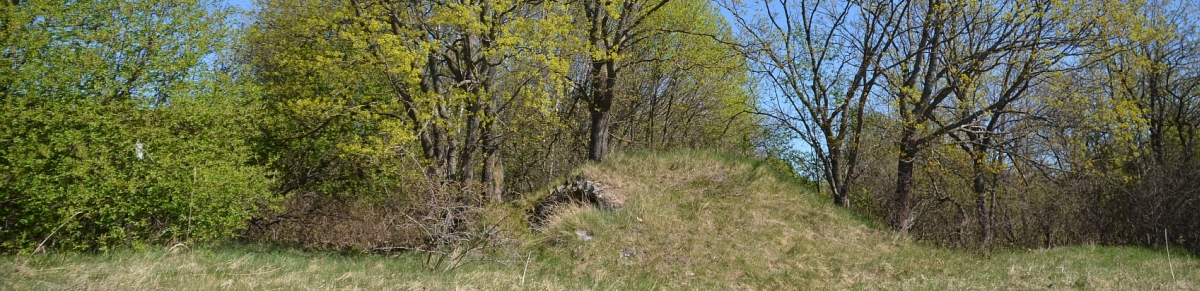
Our Waba ist in Jordan! He made amazing 407 km from last night until this evening!
He spends the night in the mountains at about 1000 m Close to or in the Dana Reserve.


Image

Image

https://i.ibb.co/RHMqXTP/Screenshot-20240503-194710.png

Image

:wave:
User avatar
Bea
Moderator
Posts: 28759
Joined: January 15th, 2011, 1:02 pm
Location: Bavaria, Germany

Post by Bea »


No new data from the OCP about WABA today, next update is scheduled for tomorrow

:wave:
Nature does nothing in vain (Aristoteles)
Treia
Registered user
Posts: 568
Joined: August 11th, 2018, 9:42 am
Location: Finland

Post by Treia »

Waba finally on the lines, what a wonderful news!!! :loveshower:
User avatar
Bea
Moderator
Posts: 28759
Joined: January 15th, 2011, 1:02 pm
Location: Bavaria, Germany

Post by Bea »


Hello everyone :hi:

Also today no new data from the OCP about WABA.

It looks like he is travelling near war zone and GPS jamming and spoofing prevents data transmission :roll:

Next update is scheduled for tomorrow

Have a good start into the new week tomorrow :wave:
Nature does nothing in vain (Aristoteles)
User avatar
Anne7
Registered user
Posts: 10705
Joined: April 15th, 2016, 3:26 pm
Location: Belgium

Post by Anne7 »

May 6th

:hi:

Our wonderful WABA sent data. :headroll:

He/she is currently already in Turkey and has passed the Gulf of Iskenderun. :thumbs:

What a strong juvenile! :2thumbsup:

3 tracker maps soon.


The day before yesterday:
▶︎ TRACKER MAP
WABA_4 May
Entire day
https://www.google.com/maps/d/edit?mid= ... sp=sharing

Distance: 518 km
Battery: 97%


The deviation to Beirut is obviously fake (jamming)

Waba spent the night slightly south of Deir Mar Musa el-Habashi monastery, near the Nasiriyah military airport, in Syria.

Image

According to "Scramble.nl" the airbase is home of two fighter squadrons of the Syrian Air Force
Image

This is how the area near Deir Mar Musa el-Habashi looks like:
Image
https://maps.app.goo.gl/rSoutM3bpX96B7DDA

Deir Mar Musa al-Habashi, literally, the Monastery of Saint Moses the Abyssinian, is a monastic community of the Syriac Catholic Church located near the town of Nabk, Syria, approximately 80 km (50 mi) north of Damascus, on the eastern slopes of the Anti-Lebanon Mountains. The main church of the monastic compound hosts precious frescoes dating to the 11th and 12th century.
(Wikipedia)

Deir Mar Musa el-Habashiis a truly amazing monastery!

A very nice video:
https://www.youtube.com/watch?v=4Afpz4cVY2M

Copyright: Mihaela Bruja

And many pictures here:
https://www.google.com/maps/place/Deir+ ... ?entry=ttu
“Clearly, animals know more than we think, and think a great deal more than we know.”
— Irene Pepperberg
User avatar
Anne7
Registered user
Posts: 10705
Joined: April 15th, 2016, 3:26 pm
Location: Belgium

Post by Anne7 »

.
Yesterday:
▶︎ TRACKER MAP
WABA_5 May
Entire day
https://www.google.com/maps/d/edit?mid= ... sp=sharing

Distance: 181 km
Battery: 85%


Yesterday, Waba flew to Al-Mughayr.
Al-Mughayr is a Syrian village located in the Karnaz Subdistrict of the Mahardah District in Hama Governorate. According to the Syria Central Bureau of Statistics, al-Mughayr had a population of 1,491 in the 2004 census. Its inhabitants are predominantly Sunni Muslims.
(Wikipedia)


Image

Image

Image
“Clearly, animals know more than we think, and think a great deal more than we know.”
— Irene Pepperberg
User avatar
Anne7
Registered user
Posts: 10705
Joined: April 15th, 2016, 3:26 pm
Location: Belgium

Post by Anne7 »

.
Today:
▶︎ TRACKER MAP
WABA_6 May
Entire day
https://www.google.com/maps/d/edit?mid= ... sp=sharing

Distance: 243 km
Battery: 93%


Today, Waba reached Turkey. S/he flew past the Gulf of Iskenderun and is currently resting between the villages Çaygeçit (Kadirli/Osmaniye) and Kızılömerli (Sumbas/Osmaniye).

Kadirli District is a district of the Osmaniye Province of Turkey. Its seat is the city of Kadirli. Its area is 1,021 km2, and its population is 127,004 (2022).

Image

Image

Image

The name of the village Çaygeçit is mentioned as Çaygeçidi in 1925 records. Çaygeçit was connected to Sumbas district on 28 October 1996, and again to Kadirli district on 27 November 1998
“Clearly, animals know more than we think, and think a great deal more than we know.”
— Irene Pepperberg
User avatar
Anne7
Registered user
Posts: 10705
Joined: April 15th, 2016, 3:26 pm
Location: Belgium

Post by Anne7 »

.
Image

:wave:
“Clearly, animals know more than we think, and think a great deal more than we know.”
— Irene Pepperberg
User avatar
Swenja
Registered user
Posts: 7519
Joined: July 3rd, 2012, 2:35 pm
Location: Berlin, Germany

Post by Swenja »

Thank you very much @Anne7 for providing the data!

Waba flies very purposefully to the north.
Continued luck and good winds for your journey! :thumbs:
Freedom!
User avatar
Anne7
Registered user
Posts: 10705
Joined: April 15th, 2016, 3:26 pm
Location: Belgium

Post by Anne7 »

May 7th

Hello everyone :hi:

Thank you, Swenja.
Yes, our wonderful Waba is a clever and strong bird! ❤️


▶︎ TRACKER MAP
WABA_7 May
From 06-05 at 17:10 UTC until 07-05 at at 17: 08 UTC
https://www.google.com/maps/d/edit?mid= ... sp=sharing

Distance: 363 km
Battery: 99%


Today, our Waba reached the area west of Konya, near the villages Mülayim and Akpınar, in the Derbent District of the Konya Province of Turkey.
At his/her last known location point, Waba was still in flight at 58 km/h. 8-)

Derbent is a municipality and district of Konya Province, Turkey. Its area is 359 km2, and its population is 4,052 (2022).
Its area is 359 km², of which approximately 10 km² is irrigable and the total area of 156 km² is agricultural land. The remaining part is settlements, forest and pasture land. In the Ottoman Period, the word "derbent" was used to mean department. In this sense, the outposts used in passages and straits on mountains are called "derbents".
Wikipedia


Image

Image

Image
“Clearly, animals know more than we think, and think a great deal more than we know.”
— Irene Pepperberg
User avatar
Anne7
Registered user
Posts: 10705
Joined: April 15th, 2016, 3:26 pm
Location: Belgium

Post by Anne7 »

.
Panoramic view of the area around Mülayim
Image
https://maps.app.goo.gl/2wRffpDBoH3LGTG98

The Derbent Mülayim Köyü Peynir İni (Nature reserve/cave) is nearby
Image
https://maps.app.goo.gl/x7UhhK1dvyj7LQLZ6

Edit:
A nice view on Waba's last known wide area.
Argazkia Konya Derbent Mülayim Köyü Peynir İni
Image
© https://eu.wikiloc.com/ibilbide-senderi ... o-94460143


Take care, dear Waba.

Have a good night, everyone. :wave:
“Clearly, animals know more than we think, and think a great deal more than we know.”
— Irene Pepperberg
User avatar
Anne7
Registered user
Posts: 10705
Joined: April 15th, 2016, 3:26 pm
Location: Belgium

Post by Anne7 »

May 8th

Hi :hi:

Our amazing WABA is already near Bursa, not very far from the Sea of Marmara in Turkey. :D
Waba travels like a confident adult BS. :thumbs:

Tracker map soon.

Here you are:

▶︎ TRACKER MAP
WABA_8 May
From 07-05 at 17:08 UTC until 08-05 at at 17:06 UTC
https://www.google.com/maps/d/edit?mid= ... sp=sharing

Distance: 383 km
Battery: 99%


Waba is near Çınarcık (Orhaneli district/Bursa province)
Çınarcık is a neighbourhood in the municipality and district of Orhaneli, Bursa Province in Turkey. Its population is 230 (2022).

Image

Image

Image
“Clearly, animals know more than we think, and think a great deal more than we know.”
— Irene Pepperberg
User avatar
Anne7
Registered user
Posts: 10705
Joined: April 15th, 2016, 3:26 pm
Location: Belgium

Post by Anne7 »

.
The Çınarcık Dam is a rock-fill dam on the Orhaneli River about 30 km east of Mustafakemalpaşa in Bursa Province, Turkey. It serves several purposes to include power, irrigation, flood control and municipal water supply to the city of Bursa. The dam was constructed between 1996 and 2002. Construction of the Uluabat Hydroelectric Station, which the dam supplies water to, began in 2006 and it was commissioned in 2010. The 125 m tall dam diverts water north through an 11.27 km long tunnel where it reaches the power station on the southern bank of Lake Uluabat. Water discharged from the 100 MW power station then enters the lake. The dam and power station are owned by the Turkish State Hydraulic Works.

BURSA, TURKIYE - JUNE 16: An aerial view of the Cinarcik Dam with surrounding trees in Cinarcik district of Bursa, Turkiye on June 16, 2023.
Copyright photo Mustafa Yilmaz/Anadolu Agency via Getty Images
https://www.gettyimages.co.uk/detail/ne ... 1259122545

The Mustafakemalpaşa River, Orhaneli River or Adirnaz River (Turkish: Mustafakemalpaşa Çayı, Orhaneli Çayı or Adırnaz Çayı) is a river in northwestern Anatolia in the Bursa Province of Turkey's Marmara Region. It is named for the city of Mustafakemalpaşa which lies near its delta onto Lake Uluabat.

Waba's current area is somewhere in the forest across the Çınarcık Reservoir.
Image
https://maps.app.goo.gl/qLFJgnGJJBXVpgoP6

And another view
Image
https://maps.app.goo.gl/yyGtQKVn52hm5B6T9

:wave:
“Clearly, animals know more than we think, and think a great deal more than we know.”
— Irene Pepperberg
Post Reply

Return to “Migration Maps and News”