
Soomaa fifth season camera
| Day's video | Forum |
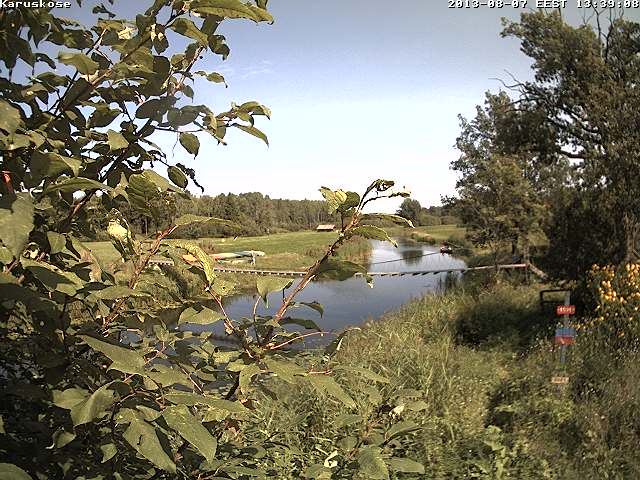
The web camera image is updated at intervals of up to a few minutes, depending on the connections. The time is quite sufficient for an overview. At the camera location at Karukose on the Raudna river brink last year previous high water level marks were attached to a tree, but last year’s flood felled the tree that had dried. Aivar Ruukel and Algis Martsoo put new marks in place.
EMHI: Halliste river, Riisa hydrological station. Water level.
Red line: month’s long-term highest level; green line: month’s long-term average water level; blue line: month’s long-term lowest level. Violet line: observed levels
EMHI Riisa station is in the estuary of Raudna river a few kilometres downstream along Halliste river, and reflects the water level of Soomaa quite well.
See the Soomaa national park on the Regio map.
A number of companies are involved in the enterprise. Many thanks to them!
Camera Mobotix - Beta Group
Video transmission from Soomaa to the Beta Group server - Televõrgu AS
Installation work – ITrotid OÜ
Soomaa arrangements – Soomaa.com
Hydrological data – EMHI
Soomaa map – Regio
Why do we add the EMHI snow cover chart which is updated? At Soomaa there is plenty of snow and the ditches have not yet begun to carry melt water from the snow to the rivers.
Soomaa and Aivar Ruukel arrange a high water forecasting competition.
Read more:


