Protected areas
Most of the more remarkable sections of the North Estonian Klint are protected areas, with the main attention being paid to the protection of the klint as the structure creating this unique landscape. Data for the following overview of protected areas were drawn from the Estonian Nature Infosystem (EELIS).
Ontika Landscape Reserve.
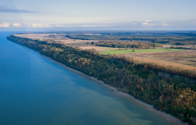
1. Osmussaar Landscape Reserve (480 ha, established in 1996) is the westernmost protected area on the North Estonian Klint. It was established mainly for the protection of the up to 6-m-high, mostly Öland-type escarpment bordering the Island of Osmussaar in the north for app. 6 km. Unique are also the Osmussaar breccia veins cropping out at the foot of the klint, which were formed as a consequence of an earthquake app. 475 million years ago, and Neugrund breccia erratic boulders, which bear witness of a meteorite explosion nearby (in the area of Neugrund Shallow) 535 million years ago. But also the gravel ridges on the coast and the juniper alvars, the unique settlement history of the island and the tragic destiny of the people are part of the values of Osmussaar Landscape Reserve.
The island is an important stopover for migrating Arctic seabirds. Numerous Long-tailed Ducks winter on the unfrozen sea here. Administratively, Osmussaar Landscape Reserve is part of Silma Nature Reserve, whose centre is located in Saare Manor in Noarootsi.
Osmussaar Island.
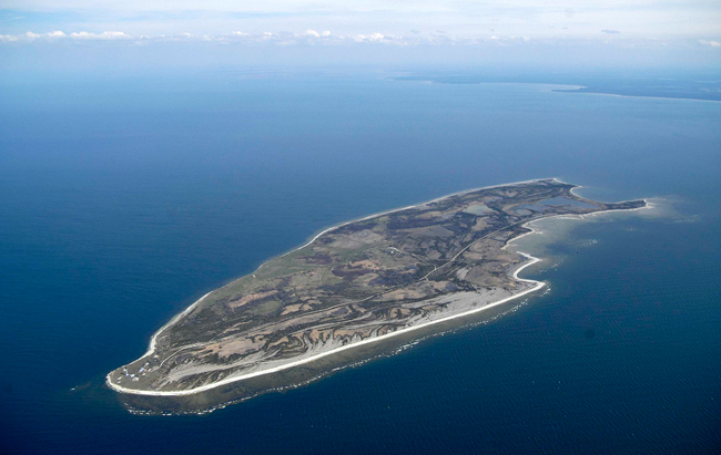
2. Pakri Landscape Reserve (1451 ha, established in 1998) encompasses the northern part of the Pakri Peninsula and the coastal area of the islands of Väike-Pakri and Suur-Pakri. The reserve includes nearly 22 km of escarpment but also the juniper alvars, alvar shrublands and open alvars on top of the klint are admirable. Pakri Cliff hosts a nesting colony of an Arctic seabird rare in Estonia – the Black Guillemot (Cepphus grylle), and a protected area has been established here for its protection.
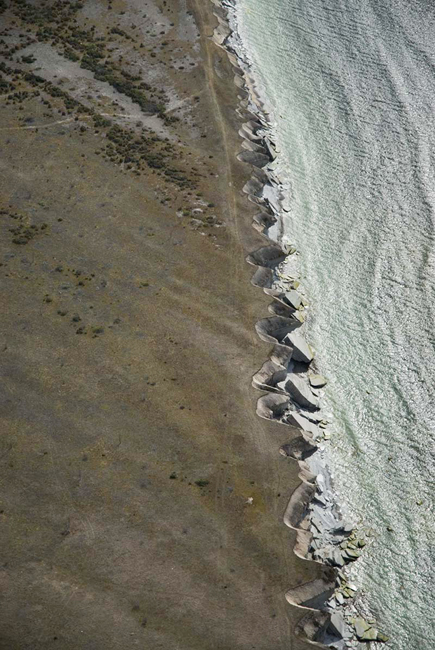
Klint in Väike-Pakri Island.
3. Türisalu Landscape Reserve (27 ha, established in 1991, new protection rules adopted in 1999) is aimed at protecting mostly the 29–31-m-high Pakri-type escarpment bordering the Laulasmaa-Türisalu Klint Peninsula in the north and the strip of klint forest under the escarpment. The alvar on top of the escarpment is protected due to its Shrubby Cinquefoil community.
Baltic Klint on Türisalu Cliff.
4. Rannamõisa Landscape Reserve (66 ha, established in 2000) encompasses a big part of the klint escarpment bordering the Suurupi Klint Peninsula, the zone of klint forest at the foot of the Ordovician-Cambrian escarpment and also a narrow strip of the klint plateau.
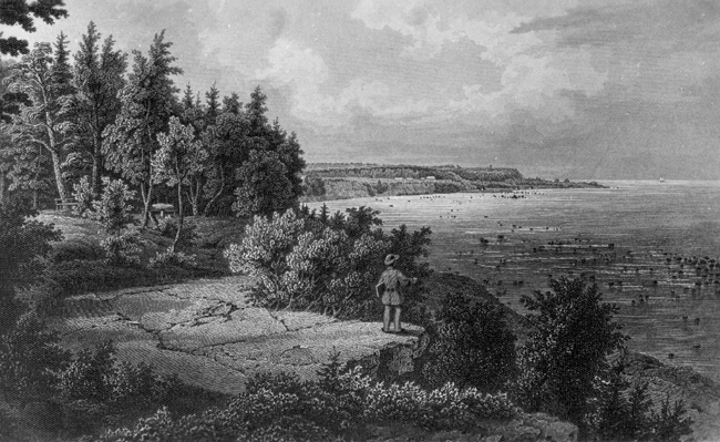
Baltic Klint at Rannamõisa (W. Stavenhagen 1867).
5. Vääna Landscape Reserve (344 ha, established in 1991, new protection rules adopted in 2000) lies somewhat off the klint escarpment, encompassing the Shrubby Cinquefoil alvars of the central part of the Türisalu Klint Peninsula and the wetland surrounding Lake Tõlinõmme, which is significant for its bird fauna.
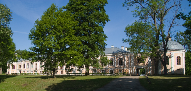
Vääna Manor.
6. Naage Landscape Reserve (4.6 ha, established in 2005) is located in Harku Municipality, Harju County, and is aimed at protecting several bat species but also the escarpment bordering Vääna Klint Bay of the North Estonian Klint.
Naage Cliff.
7. Pirita Valley Landscape Reserve (523 ha, established in 1957, new protection rules adopted in 2004) encompasses a big part of the Pirita Klint Valley. In the southern part of the landscape reserve lies the ancient Iru Fort Hill.
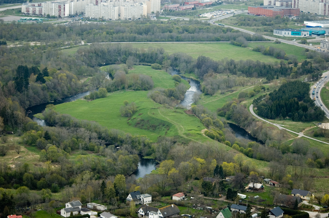
Pirita Klint Valley and Iru Fort Hill.
8. Rebala Heritage Reserve (25 km2, established in 1987, new protection rules adopted in 1998) is a historical-cultural reserve and encompasses a big part of the eastern side of the Kallavere-Ülgase Klint Peninsula and also part of the Jägala Klint Valley. Jägala Waterfall, the canyon valleys of Jägala and Jõelähtme Rivers, Kostivere Karst Field, Ülgase Cliff – all these nature monuments connected with the klint one way or another are encompassed in Rebala Reserve.
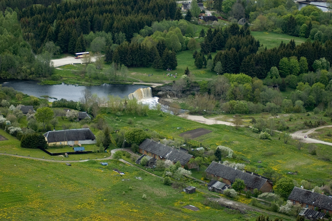
Jägala Waterfall.
9. Lahemaa National Park (72 500 ha, of which 47 410 ha is land area and 25 090 ha is aquatorium; established in 1971) is the oldest national park in Estonia. The escarpments of the Lahemaa klint section, which occur in the central part of the national park and are mostly buried to a greater or smaller extent, play a secondary role. The main purpose of the national park is to protect and introduce the coastal landscapes that have given the national park its name (Lahemaa – “Land of Bays”), i.e. the peninsulas (Juminda, Pärispea, Käsmu, Vergi) and bays (Kolga, Hara, Eru, Käsmu, Vergi). But also the off-sea and overgrowing klint peninsulas (Kolgaküla, Vatku–Muike or Ilumägi, Muuksi, Kolga), klint islands (Tsitre), bays and valleys (Pudisoo, Valgejõe, Loobu) play a role in the landscape scene of Lahemaa.
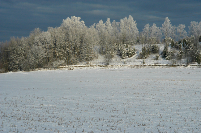
Baltic Klint at Muuksi.
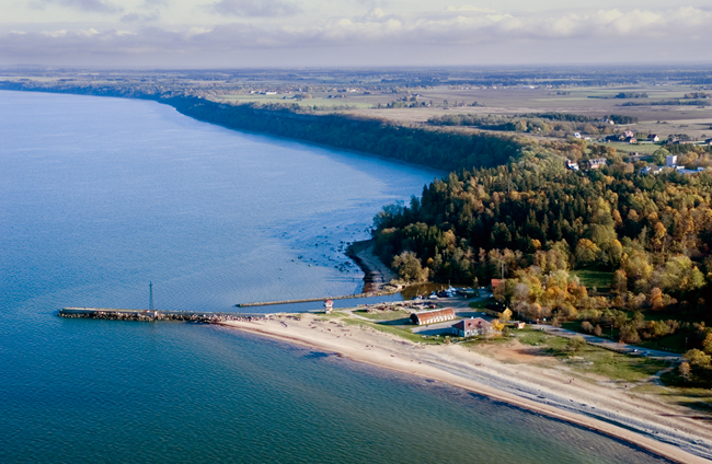
10. Toolse Landscape Reserve (12.9 ha, protection rules being drafted) encompasses the klint escarpments and the strip of klint forest beneath them in the surroundings of the deeply incised valley of the Toolse River and also a rare paludified oak forest on the river floodplain.
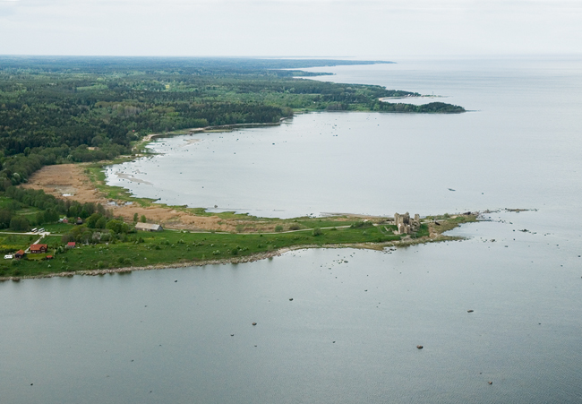
View of the ruins of Toolse Castle.
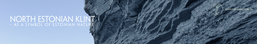
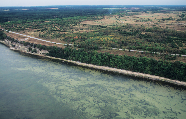
11. Ontika Landscape Reserve (1212 ha, established as Saka–Ontika–Toila Landscape Reserve in 1957 and reorganized under a new name in 1996) encompasses the 45–55-m-high Ontika-type Cambrian-Ordovician escarpment bordering the Saka-Ontika Klint Plateau in the north along with a narrow strip (50–200 m) of klint forest at the talus of the escarpment.
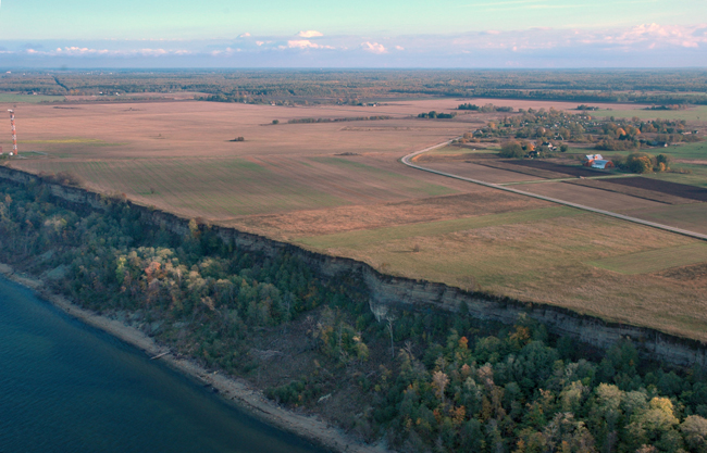
Ontika Cliff.
12. Oru Park Landscape Reserve (75 ha) encompasses the park (created in 1901) around Oru Castle – an Italian-Renaissance-style castle built in 1897–1899 by a former St. Petersburg magnate G. Yelisseyev (1858–1942) and granted to the Republic of Estonia as the President’s summer residence by Estonian businessmen in 1934. The castle was set to fire in 1941 by the retreating Soviets and the basement part, which survived the fire, was in turn blasted by retreating Germans in September 1944. The landscape reserve includes also part of the klint at the northern edge of Pühajõe Klint Island along with a narrow zone of klint forest at its talus (named Nõiamets – “Witch Forest”).
Pühajõgi Valley.
13. Päite Landscape Reserve (128.3 ha, established in 2005) is located on the Päite Klint Plateau in Ida-Viru County and is aimed at protecting the stretch of klint between Toila and Sillamäe and the associated seminatural communities.
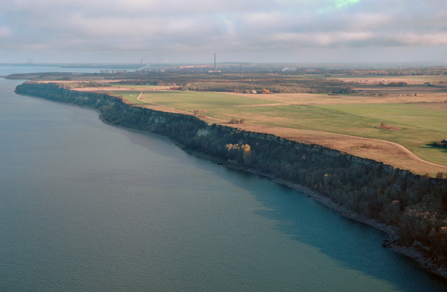
Baltic Klint at Päite Cliff.
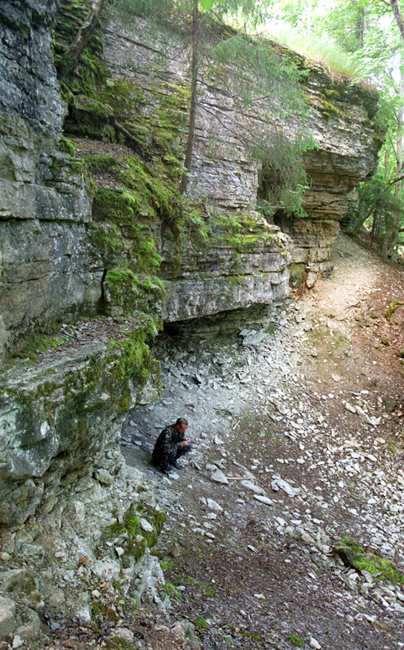
14. Vaivara Landscape Reserve (79 ha, designated in 1959, reorganized in 1998) was established for the protection of the Vaivara Sinimäed (“Blue Hills”) – a nearly 3-km chain of three unique glacial uplifts (or rafts) named Tornimägi, Põrguhauamägi, Pargimägi. During World War II, the Sinimäed became the field of high-casualty battles. The monuments dedicated to these events add a historical aspect to the reserve.
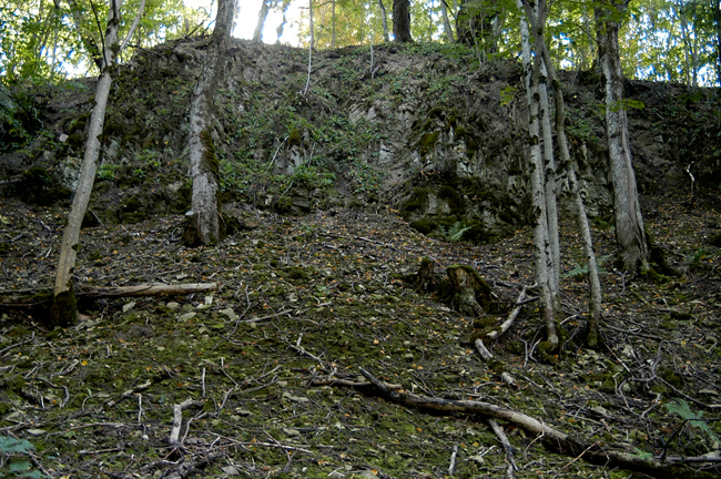
Uplifted bedrock block on the northern slope of Tornimägi Hill.
15. Narva River Canyon Landscape Reserve (14 ha, designated in 1959) aims to protect the outcrops of Lower Palaeozoic rocks on the western bank of the Narva River Canyon-valley and a relic hill in the valley in Narva City and waterfall escarpments in the northern part of Kreenholm Island.
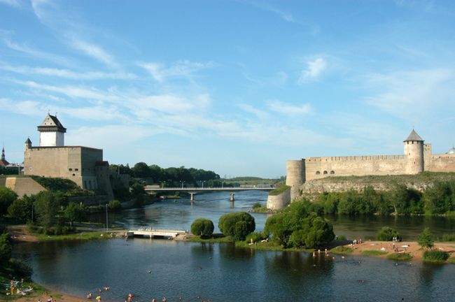
Narva River Canyon.
