
'Fifth season' in Soomaa
Camera image is provided by Beta Group and Televõrgu AS
| video of a day | foorum |
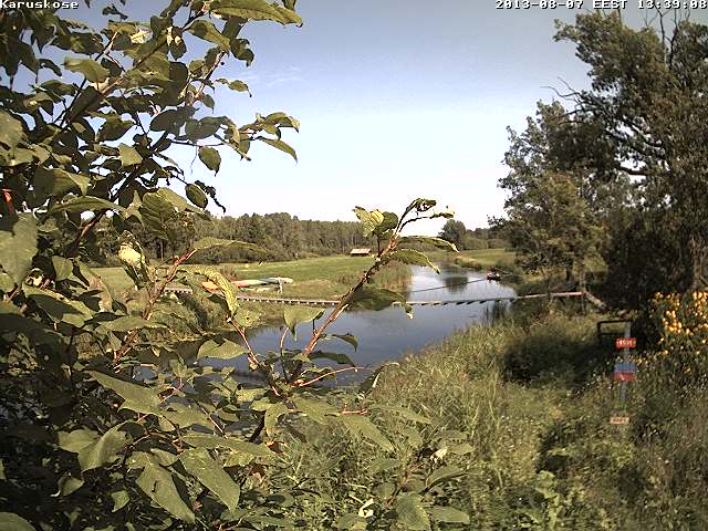
The web camera image above is renewed at intervals of up to a few minutes, depending on the transmission conditions. For an overall view this interval is quite sufficient. In the image from the camera at Karukose at Raudna river an orange band showing last year's highest water level, and a green band showing the highest recorded level, in 1956, can be seen.
The Riisa station of EMHI, the Estonian Meteorological and Hydrological Institute, is located a few kilometres downstream along Halliste river from the outflow of Raudna river, and reflects the water level in Soomaa (see graph below).
Why do we also add EMHI’s snow cover map, renewed every day? Because there is still emough snow left in Soomaa, and the ditches haven’t yet started carrying the water into the rivers.
Floods can also be observed in the Regio map. The NASA satellite image, renewed daily, is used as a basis. It needs only enlarging the map at Soomaa’s position. The ground and water surfaces can only be seen in clear, cloudless weather.
A great number of splendid people and organisations assist in the enterprise. Many thanks to them!
Camera – Mobotix, Beta Group – Veematkad
Video transmission from Soomaa to the Beta Group server - Televõrgu AS
Installation works – ITrotid OÜ
Video transmission from Soomaa to the Beta Group server - Televõrgu AS
Installation works – ITrotid OÜ
Technical support – Sonictest OÜ
Soomaa expertise – Soomaa.com
Hydrological data – EMHI
Soomaa map – Regio
Soomaa expertise – Soomaa.com
Hydrological data – EMHI
Soomaa map – Regio
...and the eagle-eyed nature enthusiasts at Looduskalender´s forum
Thckness of snow cover (cm), map renewed at 08:00 am.
EMHI: Halliste River, Riisa hydrometric station.
Highest (red), average (green), and lowest (blue) recorded water levels 1938-2005, and presently recorded (violet) level.


